


The pandemic-era ‘slow streets’ experiment has met with mixed reviews from residents, prompting the city to consider the removal or adjustment of many segments.
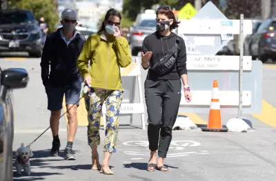
Of the nearly 30 ‘slow streets’ installed in San Francisco during the pandemic and “designed to limit through traffic on some residential streets to create a common, shared space for those also traveling on foot and by bicycle,” Max Darrow reports that “There are four slow street corridors that the SFMTA board authorized to stay in place beyond the state of emergency: Golden Gate Ave., Lake St., Sanchez St., and Shotwell St.”
Locals are divided on their utility. One resident, Vince Meyer, “Meyer thinks the slow street corridors will make the streets safer, will benefit the environment, and will be good for neighborhoods.” Another, Elisa Smith, says “A lot of these are just causing more problems than they are a source of enjoyment for people.” According to Smith, “There should be probably, an assessment done, of which ones are highly, highly used, and which ones are not.”
Darrow notes that “The SFMTA has removed several slow streets that were put up during the pandemic, such as Duncan, Excelsior, and Mariposa, due to low use and conflicts with other planning efforts, according to a spokesperson.”
FULL STORY: Quentions linger over future of San Francisco neighborhood 'Slow Streets'

San Francisco Nixes Slow Street
Lake Street’s designation as a ‘slow street’ is overwhelmingly popular with residents. Why does the city plan to dismantle it?
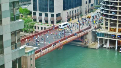
Chicago Dismantles Leland 'Slow Street' Three Months Early
Citing neighborhood concerns, the city is ending the Slow Street program on Leland Street as more parks and beaches reopen, but advocates want to see more permanent traffic calming measures.
The Slow Streets Reckoning
Slow streets programs provided a quick short-term solution and paved the way for some permanent street closures and realignments. Now, these programs are getting a second look as community groups react to the changes.

Alabama: Trump Terminates Settlements for Black Communities Harmed By Raw Sewage
Trump deemed the landmark civil rights agreement “illegal DEI and environmental justice policy.”

Planetizen Federal Action Tracker
A weekly monitor of how Trump’s orders and actions are impacting planners and planning in America.

The 120 Year Old Tiny Home Villages That Sheltered San Francisco’s Earthquake Refugees
More than a century ago, San Francisco mobilized to house thousands of residents displaced by the 1906 earthquake. Could their strategy offer a model for the present?

Ken Jennings Launches Transit Web Series
The Jeopardy champ wants you to ride public transit.

BLM To Rescind Public Lands Rule
The change will downgrade conservation, once again putting federal land at risk for mining and other extractive uses.

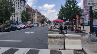
Indy Neighborhood Group Builds Temporary Multi-Use Path
Community members, aided in part by funding from the city, repurposed a vehicle lane to create a protected bike and pedestrian path for the summer season.
Urban Design for Planners 1: Software Tools
This six-course series explores essential urban design concepts using open source software and equips planners with the tools they need to participate fully in the urban design process.
Planning for Universal Design
Learn the tools for implementing Universal Design in planning regulations.
Clanton & Associates, Inc.
Jessamine County Fiscal Court
Institute for Housing and Urban Development Studies (IHS)
City of Grandview
Harvard GSD Executive Education
Toledo-Lucas County Plan Commissions
Salt Lake City
NYU Wagner Graduate School of Public Service