


The Pennsylvania Avenue Initiative seeks to redesign the capital’s most famous thoroughfare to include more park space and pedestrian amenities.
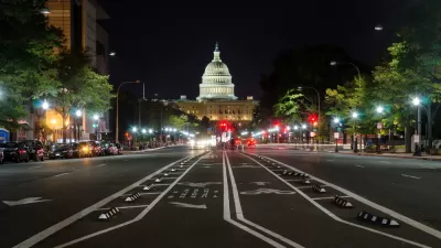
“Urban planners want to re-imagine downtown D.C.’s Pennsylvania Avenue as a signature outdoor venue, emphasizing people over cars and expanding park space between the White House and the U.S. Capitol.” As reported by Alejandro Alvarez, the Pennsylvania Avenue Initiative has proposed three potential makeovers of the famous street. “The three visions deal with different approaches to balancing pedestrian needs, recreational space and vehicle traffic, citing a 2018 D.C. transportation study that found up to 20 feet of the avenue’s current lanes could be allocated to other uses while preserving an ‘acceptable’ level of service (LOS) for vehicles.”
One plan would focus on sidewalk expansion without changing much else about existing traffic patterns. A second, “ would transform wide swathes of Pennsylvania Avenue into a curb-less pedestrian park with winding footpaths and large lawns, leaving a vestige of the roadway at its center for public transit and bike use.” The third concept would “would bisect the avenue with a mile-long central pedestrian promenade running its entire length, flanked on both sides by a combination of narrower travel and bike lanes.”
According to the article, “Planners also identified three popular public spaces along Pennsylvania Avenue, roughly correlating to the areas around Freedom Plaza, the Navy Memorial and John Marshall Park, that would be expanded under each proposal ‘to encourage a range of plaza and park-related activities with retail services and amenities.’” The Initiative’s StoryMaps site features renderings and maps of the proposed concepts.
FULL STORY: Urban planners detail 3 ways to re-imagine DC’s Pennsylvania Avenue


Has Progress on Travel Safety Run Off the Road?
Changing technology and rebuilding infrastructure to improve road safety are long-term strategies. How can enforcement and interventions that influence driver behavior make a difference in reducing traffic deaths sooner?
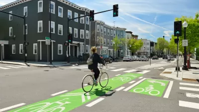
NACTO Releases Updated Urban Bikeway Guide
The third edition of the nationally recognized road design guide includes detailed design advice for roads that prioritize safety and accessibility for all users.

US Street Design Manual Inches Toward Safer Roads
The guiding document for U.S. road design is starting to recognize the needs of people walking and biking, but safe streets advocates say more significant changes are needed to reduce the high number of pedestrian deaths and improve connectivity for all road users.

Alabama: Trump Terminates Settlements for Black Communities Harmed By Raw Sewage
Trump deemed the landmark civil rights agreement “illegal DEI and environmental justice policy.”

Planetizen Federal Action Tracker
A weekly monitor of how Trump’s orders and actions are impacting planners and planning in America.

The 120 Year Old Tiny Home Villages That Sheltered San Francisco’s Earthquake Refugees
More than a century ago, San Francisco mobilized to house thousands of residents displaced by the 1906 earthquake. Could their strategy offer a model for the present?

In Both Crashes and Crime, Public Transportation is Far Safer than Driving
Contrary to popular assumptions, public transportation has far lower crash and crime rates than automobile travel. For safer communities, improve and encourage transit travel.

Report: Zoning Reforms Should Complement Nashville’s Ambitious Transit Plan
Without reform, restrictive zoning codes will limit the impact of the city’s planned transit expansion and could exclude some of the residents who depend on transit the most.

Judge Orders Release of Frozen IRA, IIJA Funding
The decision is a victory for environmental groups who charged that freezing funds for critical infrastructure and disaster response programs caused “real and irreparable harm” to communities.
Urban Design for Planners 1: Software Tools
This six-course series explores essential urban design concepts using open source software and equips planners with the tools they need to participate fully in the urban design process.
Planning for Universal Design
Learn the tools for implementing Universal Design in planning regulations.
Clanton & Associates, Inc.
Jessamine County Fiscal Court
Institute for Housing and Urban Development Studies (IHS)
City of Grandview
Harvard GSD Executive Education
Toledo-Lucas County Plan Commissions
Salt Lake City
NYU Wagner Graduate School of Public Service