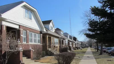
Forget red state versus blue state: a new data analysis and mapping project by The New York Times shows that the political divides in the country can be mapped to the neighborhood level within metropolitan areas.

Emily Badger, Kevin Quealy, and Josh Katz present an info-graphic-rich data journalism feature that reveals the partisan divides evident in the geography of the United States—in far greater detail than the red-blue and urban-rural divide that is already searingly rendered on so many elections maps. The big surprise of this exercise: the partisan dive of U.S. communities is visible at the local level, within urban areas.
"Democrats and Republicans live apart from each other, down to the neighborhood, to a degree that raises provocative questions about how closely lifestyle preferences have become aligned with politics and how even neighbors may influence one another," according to the article.
The analysis is made possible by analyzing the individual addresses for 180 million registered voters. The data reveals that "nearly all American voters live in communities where they are less likely to encounter people with opposing politics than we’d expect."
Maps of Los Angeles, Chicago, Dallas, and New York top the article, but the same patterns are visible in Atlanta, Baltimore, Austin, Indianapolis, Boston, Cincinnati, Charlotte, Detroit, Birmingham, Columbus, Denver, Houston, and more.
As for what explains these patterns, the article suggest that geographic alignment follows educational realignment,"with the changes concentrated in highly educated suburbs and more working-class towns and rural communities." Racial segregation also plays a factor in partisan clustering, according to the article. "African-American voters in particular are overwhelmingly Democratic and also residentially segregated (metro Milwaukee’s map of partisan segregation, for one, resembles its map of racial segregation)."
A lot more analysis on both cause and effect is included in the source article.
FULL STORY: A Close-Up Picture of Partisan Segregation, Among 180 Million Voters

Trump Administration Could Effectively End Housing Voucher Program
Federal officials are eyeing major cuts to the Section 8 program that helps millions of low-income households pay rent.

Planetizen Federal Action Tracker
A weekly monitor of how Trump’s orders and actions are impacting planners and planning in America.

Ken Jennings Launches Transit Web Series
The Jeopardy champ wants you to ride public transit.

California Invests Additional $5M in Electric School Buses
The state wants to electrify all of its school bus fleets by 2035.

Austin Launches $2M Homelessness Prevention Fund
A new grant program from the city’s Homeless Strategy Office will fund rental assistance and supportive services.

Alabama School Forestry Initiative Brings Trees to Schoolyards
Trees can improve physical and mental health for students and commnity members.
Urban Design for Planners 1: Software Tools
This six-course series explores essential urban design concepts using open source software and equips planners with the tools they need to participate fully in the urban design process.
Planning for Universal Design
Learn the tools for implementing Universal Design in planning regulations.
Ada County Highway District
Clanton & Associates, Inc.
Jessamine County Fiscal Court
Institute for Housing and Urban Development Studies (IHS)
City of Grandview
Harvard GSD Executive Education
Toledo-Lucas County Plan Commissions
Salt Lake City
NYU Wagner Graduate School of Public Service


