


In 1970, half of the city's census tracts were middle-income. Now, only 16 percent of them remain so. Polarization between the well-off and the poor essentially splits the city in two.
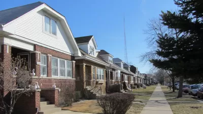
Researchers from the Nathalie P. Voorhees Center at the University of Illinois at Chicago have compiled a troubling set of maps showing how severely the city's middle class has shrunk over the past half-century.
"UIC's maps show that fully half of the city was middle income in 1970, including large swaths on every side of town," Linda Lutton writes. "Today, just 16 percent of the city's 797 census tracts are considered middle income. Those middle income areas are confined mostly to the corners of the city, and to thin strips between areas of wealth and poverty."
"Stubborn" racial segregation is one part of the story, as is the recent arrival of high-income households staking claims on the city's North Side. "Just 8 percent of Chicago's census tracts were considered high or very high income in 1970. Today, more than one-fifth of the city's census tracts are higher income." Low-income neighborhoods in the city's south and west tend to be majority black or Latino.
Meanwhile, says demographer Rob Paral, the North Side's rising affluence maps to education: people with higher degrees are replacing previous middle-class residents. Some affluent residents "buy half-million-dollar homes nearby that they tear down to use as side yards," according to a local realtor. "Two-flats, which middle-class families could afford because of the rental income, are now regularly converted to single-family homes," Lutton writes.
FULL STORY: The Middle Class Is Shrinking Everywhere — In Chicago It’s Almost Gone

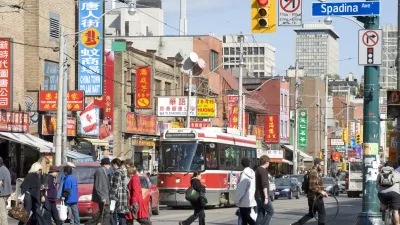
New Research Shows Toronto Highly Segregated Along Race and Class Lines
A closer look at the numbers reveals stark divides among Toronto neighborhoods.
Study: More Than Income, Race Influences Neighborhood Standards
Although income inequality receives plenty of coverage these days, research suggests that neighborhoods of color have less access to resources than white neighborhoods despite similar median incomes.
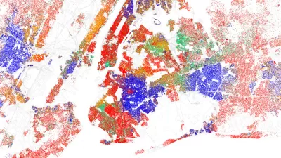
Examining the Surprising Segregation of New York City
The common perception of New York City is as of a well-integrated city, full of multi-ethnic neighborhoods. But a recent article peeks behind the curtain of the city’s surprising boundaries of racial segregation.

Study: Maui’s Plan to Convert Vacation Rentals to Long-Term Housing Could Cause Nearly $1 Billion Economic Loss
The plan would reduce visitor accommodation by 25,% resulting in 1,900 jobs lost.

North Texas Transit Leaders Tout Benefits of TOD for Growing Region
At a summit focused on transit-oriented development, policymakers discussed how North Texas’ expanded light rail system can serve as a tool for economic growth.

Why Should We Subsidize Public Transportation?
Many public transit agencies face financial stress due to rising costs, declining fare revenue, and declining subsidies. Transit advocates must provide a strong business case for increasing public transit funding.

How to Make US Trains Faster
Changes to boarding platforms and a switch to electric trains could improve U.S. passenger rail service without the added cost of high-speed rail.

Columbia’s Revitalized ‘Loop’ Is a Hub for Local Entrepreneurs
A focus on small businesses is helping a commercial corridor in Columbia, Missouri thrive.

Invasive Insect Threatens Minnesota’s Ash Forests
The Emerald Ash Borer is a rapidly spreading invasive pest threatening Minnesota’s ash trees, and homeowners are encouraged to plant diverse replacement species, avoid moving ash firewood, and monitor for signs of infestation.
Urban Design for Planners 1: Software Tools
This six-course series explores essential urban design concepts using open source software and equips planners with the tools they need to participate fully in the urban design process.
Planning for Universal Design
Learn the tools for implementing Universal Design in planning regulations.
City of Santa Clarita
Ascent Environmental
Institute for Housing and Urban Development Studies (IHS)
City of Grandview
Harvard GSD Executive Education
Toledo-Lucas County Plan Commissions
Salt Lake City
NYU Wagner Graduate School of Public Service