


Under the transit tab on Google Maps, users will now be able to incorporate trips that start on a bike but end on a bus, train, or other mode of transport.

Google now offers multi-modal directions on some platforms. Travelers can use their phones not only to look up transit, walking, car, or biking directions, but now they can also use the service to get directions that incorporate multiple modes. This new feature is meant to help give information relevant to each leg of a multimodal journey including information about how crowded trains are, what traffic is like, and how long one would be likely to wait for a train.
"Transit directions paired with ride-sharing and biking will start rolling today out on iOS. Android users will also get transit plus ride-sharing starting today, but they will have to wait a little longer for transit plus biking," Andrew J. Hawkins reports for the Verge.
FULL STORY: Google Maps will now let users combine transit directions with biking and ride-sharing

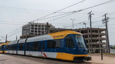
Two Years In, a Look at the Twin Cities Fare Discount Program
In 2017, Metro Transit in the Twin Cities raised fares but also started a program for low-income riders to help ease the burden of travel costs.
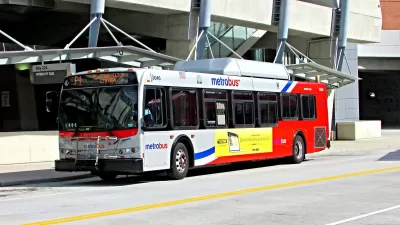
D.C.-Area Residents Want Bus Lanes and Free Transfers, Survey Shows
New survey findings identify transit priorities among residents in D.C. and surrounding areas, and indicate broad support for public investments.

Google's New 'Visual Position System' Takes Pedestrian Navigation to the Next Level
In case you've ever felt like Google Maps isn't as helpful on foot as it is in a car, there's a new technology just for you.

Alabama: Trump Terminates Settlements for Black Communities Harmed By Raw Sewage
Trump deemed the landmark civil rights agreement “illegal DEI and environmental justice policy.”

Planetizen Federal Action Tracker
A weekly monitor of how Trump’s orders and actions are impacting planners and planning in America.

The 120 Year Old Tiny Home Villages That Sheltered San Francisco’s Earthquake Refugees
More than a century ago, San Francisco mobilized to house thousands of residents displaced by the 1906 earthquake. Could their strategy offer a model for the present?

In Both Crashes and Crime, Public Transportation is Far Safer than Driving
Contrary to popular assumptions, public transportation has far lower crash and crime rates than automobile travel. For safer communities, improve and encourage transit travel.

Report: Zoning Reforms Should Complement Nashville’s Ambitious Transit Plan
Without reform, restrictive zoning codes will limit the impact of the city’s planned transit expansion and could exclude some of the residents who depend on transit the most.

Judge Orders Release of Frozen IRA, IIJA Funding
The decision is a victory for environmental groups who charged that freezing funds for critical infrastructure and disaster response programs caused “real and irreparable harm” to communities.
Urban Design for Planners 1: Software Tools
This six-course series explores essential urban design concepts using open source software and equips planners with the tools they need to participate fully in the urban design process.
Planning for Universal Design
Learn the tools for implementing Universal Design in planning regulations.
Clanton & Associates, Inc.
Jessamine County Fiscal Court
Institute for Housing and Urban Development Studies (IHS)
City of Grandview
Harvard GSD Executive Education
Toledo-Lucas County Plan Commissions
Salt Lake City
NYU Wagner Graduate School of Public Service