


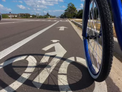
Arterial roads and poorly designed intersections pose significant threats to cyclist and pedestrian safety.
In a collaboration with BikeMaps.org dubbed the #2020CyclingDeaths project, Maura Fox and Luke Whelan assess cycling deaths on American roads in the past year to see where, how, and how many bicyclists are dying. "Record numbers of cyclists (and thousands of pedestrians) on our nation’s roads are being killed by drivers often without any media attention beyond a brief local news story," the authors write.
Their study captured 697 deaths between January 2020 and January 2021. "Since we were only able to count deaths reported by local media, the actual total is likely significantly higher." BikeMaps.org, a project started by Trisalyn Nelson, crowdsources information about cyclist crashes, near misses, traffic hazards, and bike thefts in the United States and Canada.
Key takeaways from the study show that more than a quarter of crashes are hit-and-runs, and cycling deaths occur all over (project data came from 47 states), with the highest numbers of deaths occurring in California and Florida, followed by New York and Texas. Surprisingly, rural, suburban, and urban areas have similar rates of cycling deaths. Despite lower density and less traffic, rural roads aren't designed to protect people on bikes. According to the data, the most dangerous place for cyclists is an arterial road, "a busy, multilane thoroughfare with traffic signals at intersections and speeds limits exceeding 30 miles per hour," which account for 65% of fatal crashes.
The authors suggest some solutions for planners and policymakers, including incorporating a car’s potential risk to cyclists and pedestrians with vehicle-safety ratings, improving education for drivers, and incentivizing cycling to induce more ridership.
FULL STORY: What We Learned from Tracking Cycling Deaths for a Year

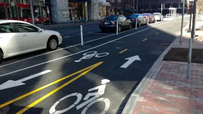
Nation's Top Safety Board Recommends Protected Bike Lanes
The NTSB chair issued a stark warning on Nov. 5: "If we do not improve roadway infrastructure for bicyclists, bicyclists will die who otherwise would not," stated Robert Sumwalt in introducing their first report in 47 years devoted to bike safety.

Proposed Bill Would Direct Funds to Road Safety
The Sarah Debbink Langenkamp Active Transportation Safety Act was spurred by the death of a U.S. diplomat who was killed on her bicycle.
Sharrows Are Ineffective, Potentially Counterproductive
Research shows there’s no substitute for protected bike lanes, and sharrows may make roads more dangerous for cyclists.

Alabama: Trump Terminates Settlements for Black Communities Harmed By Raw Sewage
Trump deemed the landmark civil rights agreement “illegal DEI and environmental justice policy.”

Planetizen Federal Action Tracker
A weekly monitor of how Trump’s orders and actions are impacting planners and planning in America.

The 120 Year Old Tiny Home Villages That Sheltered San Francisco’s Earthquake Refugees
More than a century ago, San Francisco mobilized to house thousands of residents displaced by the 1906 earthquake. Could their strategy offer a model for the present?

LA’s Tree Emergency Goes Beyond Vandalism
After a vandal destroyed dozens of downtown LA trees, Mayor Karen Bass vowed to replace them. Days later, she slashed the city’s tree budget.

Sacramento Leads Nation With Bus-Mounted Bike Lane Enforcement Cameras
The city is the first to use its bus-mounted traffic enforcement system to cite drivers who park or drive in bike lanes.

Seattle Voters Approve Social Housing Referendum
Voters approved a corporate tax to fund the city’s housing authority despite an opposition campaign funded by Amazon and Microsoft.
Urban Design for Planners 1: Software Tools
This six-course series explores essential urban design concepts using open source software and equips planners with the tools they need to participate fully in the urban design process.
Planning for Universal Design
Learn the tools for implementing Universal Design in planning regulations.
Ada County Highway District
Clanton & Associates, Inc.
Jessamine County Fiscal Court
Institute for Housing and Urban Development Studies (IHS)
City of Grandview
Harvard GSD Executive Education
Toledo-Lucas County Plan Commissions
Salt Lake City
NYU Wagner Graduate School of Public Service