


This new Manual is a guide for evaluating peoples' ability to access services and activities, and therefore the performance of transportation and land use configurations.
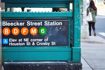
Transportation planning is shifting from evaluating mobility (physical movement) to accessibility (people's ability to reach desired services and activities), which expands the range of solutions that can be applied to transportation problems. For example, mobility-based planning assumes that the preferred solution to traffic congestion is to expand roadways so motorists can travel faster and farther. Accessibility-based planning considers roadway expansions, improvements to non-auto modes (such as bicycle improvements and grade-separated transit), development reforms to reduce the distances that people must travel, pricing reforms and commute trip reduction programs that encourage use of more space-efficient modes, plus mobility substitutes such as telework and delivery services. Access-based analysis is more complicated, but better reflects what want want overall: the ability to reach desired services and activities. It leads to more multimodal transportation systems and more compact and connected communities.

This new book, Transport Access Manual: A Guide for Measuring Connection between People and Places, provides practical information on how to measure these impacts. It is a guide for quantifying and evaluating access for anybody interested in truly understanding how to measure the performance of transport and land use configurations. It contains enough information to help transport and planning professionals achieve a more comprehensive look at their city or region than traditional transport analysis allows. It provides a point of entry for interested members of the public as well as practitioners by being organized in a logical and straightforward way. It is now available as a free PDF document, or as a hard-copy book.
Thanks to Professors David Levinson and David King for their great leadership on this project.
FULL STORY: Transport Access Manual: A Guide for Measuring Connection between People and Places

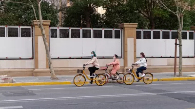
An International Comparison of Transportation Modes
Access (the ease of reaching desired destinations) is a key factor in transport, sustainability, and urban planning. This new study applies multimodal accessibility analysis to 4 modes in 117 cities in 6 countries, illustrated graphically.

New Orleans Makes Push for Accessibility Improvements Ahead of Super Bowl
Major sporting events like the Olympics and the Super Bowl can serve as catalysts for major changes in transportation infrastructure and accessibility.

Planning for Accessibility: Proximity is More Important than Mobility
Accessibility-based planning minimizes the distance that people must travel to reach desired services and activities. Measured this way, increased density can provide more total benefits than increased speeds.

Trump Administration Could Effectively End Housing Voucher Program
Federal officials are eyeing major cuts to the Section 8 program that helps millions of low-income households pay rent.

Planetizen Federal Action Tracker
A weekly monitor of how Trump’s orders and actions are impacting planners and planning in America.

The 120 Year Old Tiny Home Villages That Sheltered San Francisco’s Earthquake Refugees
More than a century ago, San Francisco mobilized to house thousands of residents displaced by the 1906 earthquake. Could their strategy offer a model for the present?

Alabama School Forestry Initiative Brings Trees to Schoolyards
Trees can improve physical and mental health for students and commnity members.

NYC Outdoor Dining Could Get a Re-Do
The city council is considering making the al fresco dining program year-round to address cost concerns from small businesses.

HSR Reaches Key Settlement in Northern California City
The state’s high-speed rail authority reached an agreement with Millbrae, a key city on the train’s proposed route to San Francisco.
Urban Design for Planners 1: Software Tools
This six-course series explores essential urban design concepts using open source software and equips planners with the tools they need to participate fully in the urban design process.
Planning for Universal Design
Learn the tools for implementing Universal Design in planning regulations.
Ada County Highway District
Clanton & Associates, Inc.
Jessamine County Fiscal Court
Institute for Housing and Urban Development Studies (IHS)
City of Grandview
Harvard GSD Executive Education
Toledo-Lucas County Plan Commissions
Salt Lake City
NYU Wagner Graduate School of Public Service