


Modern demands for curbside space call for new ways to manage and allocate it.

As cities become increasingly congested and the demand for curb space intensifies, urban planners face new and evolving challenges. From delivery trucks double-parking to rideshare vehicles crowding the curb, the growing complexity of curb usage is impacting not only traffic flow but also urban livability. No longer is the curbside a passive space reserved for parking and kept clear for rush hour; it has become a vital urban asset that must be managed dynamically to accommodate the growing demands of urban mobility.
To address these challenges, cities around the world are turning to curb management and associated technologies. These technological solutions help cities understand their curbside, optimize curb use, improve access to public space, and balance the competing demands for curbside real estate equitably. By leveraging technology, municipalities are finding ways to accommodate multiple users while maintaining safety, reducing congestion, and improving the overall efficiency of urban transportation networks.
This article explores how three communities — West Hollywood, California; Dublin, Ireland; and Arlington County, Virginia — faced unique curbside challenges and how innovative curb management solutions helped address them. Each case offers valuable insights into how cities can leverage technology to reimagine their curbs for a more sustainable and equitable future.
The expanding role of the curb in urban mobility
Traditionally, curb space has been managed through static regulations, at their most rudimentary denoted via colored paint on the curb, but often shown via signage indicating where vehicles can park and for how long. These systems were designed for a simpler time, before the rise of e-commerce, on-demand rideshares, and urban cycling networks. In today’s cities, the curb has evolved into a dynamic and contested space that must serve a wide variety of uses, often simultaneously.
Cities are now tasked with balancing the needs of pedestrians, cyclists, public transit users, delivery trucks, and private vehicles, all vying for access to the same limited curbside real estate. The stakes are high: inefficient curb management contributes to traffic congestion, reduces air quality, and creates safety hazards. At the same time, urban planners must also consider the need to create more accessible, walkable, and livable cities. People still need places to park, too.
As a result, the importance of smart curb management technology has grown significantly. These systems offer real-time insights into how curbs are being used and allow cities to manage them dynamically, adapting to changing demands throughout the day. By digitizing curbside regulations and integrating data from sensors, traffic cameras, and mobile applications, smart curb management tools help cities make data-driven decisions to optimize their curb spaces.
West Hollywood: Addressing congestion and equity with intelligent curb management
West Hollywood, California, a bustling city known for its nightlife and high foot traffic, faced growing congestion issues as demand for curb space increased. With a high volume of delivery vehicles, rideshares, and local traffic all competing for space, curbside mismanagement led to double parking, increased idling, and blocked access for pedestrians and cyclists. Additionally, permits at the curbside were needed for movie shoots and other loading activities, and the City needed a way to make sure the same curb space wasn’t reserved twice on the same day by mistake.
To address these issues, the City implemented an Intelligent Curb Management System that leverages digital tools like CurbIQ to take an inventory of their entire space by space curbside across the city. This system provided city planners with data on how curb space was designated or reserved, enabling them to reallocate space for different uses at different times of the day or make changes for movie shoots or other events. For example, certain areas were analyzed to see if they were candidates for conversion into loading zones during peak delivery hours, while others could be designated for rideshares during nightlife hours. This flexibility would allow the city to allocate space more efficiently, reducing congestion and improving access for all users.
One of the lessons from West Hollywood’s experience is the importance of equity in curb management. By using data to understand which areas were most affected by congestion and access issues, the City could make more informed decisions about how to allocate curb space fairly. This system supports the City’s broader goals of promoting active transportation and reducing reliance on private vehicles.
Dublin: Balancing historic charm with modern mobility needs
In Dublin, Ireland, the challenge of curb management took on a unique dimension due to the city’s historic streets and narrow lanes. Dublin’s Temple Bar district, a popular tourist destination known for its cobblestone streets and cultural attractions, became a focal point for curbside congestion as delivery vehicles struggled to navigate the area and find loading zones. With narrow streets and limited space, delivery trucks often blocked pedestrian pathways and created traffic bottlenecks.
To address these challenges, Dublin embarked on a Digital Mapping and Curbside Management project that created a detailed inventory of the city’s curb regulations, as part of their broader European Union initiative via the SENATOR platform and its living lab. The goal was to improve urban logistics, and the Smart Dublin team recognized that this starts with understanding their curbside and creating an inventory.
This digital inventory allowed the city to better understand how curb space was being used and where improvements were needed. This was enhanced by in-ground sensors in certain loading bays. By integrating sensor data from loading zones, Dublin has been able to monitor curbside activity in real-time and make data-driven decisions about expanding or contracting loading areas, andto understand where loading bays are being misused.
Dublin’s experience highlights the importance of flexibility in curb management. By leveraging technology to monitor and adjust curbside regulations in real time, cities can better balance the needs of different users and create more efficient and accessible urban spaces.
Arlington County: Using data to drive curbside efficiency
Arlington County, Virginia, faced a different set of challenges as it sought to manage curb space in a growing suburban environment. With a mix of residential, commercial, and public transit demands, Arlington’s curbs were often underutilized or misallocated. The county recognized that simply adding more parking spaces would not solve the problem. Instead, it needed a data-driven approach to optimize curb usage. They wanted to make busier parking areas cost more and spaces with low utilization to cost less to incentivize people to use curb space across the county better.
To achieve this, Arlington County implemented a Performance Parking System Solution that integrated data from almost 5,000 in-ground parking occupancy sensors, along with transaction data from payment systems.
This Performance Parking system provided the county with a real-time view of how both on-street and off-street spaces were being used every minute of the day, enabling planners to adjust parking availability and pricing dynamically based on demand. By using variable pricing, Arlington was able to incentivize drivers to park in less congested areas, freeing up curb space in high-demand locations. Insights from CurbIQ have helped inform pricing changes, such as an increase in daily sessions in some areas, and led to a decrease in average occupancy, demonstrating that the availability of parking supply is increasing.
The success of Arlington’s performance parking system affirms the power of data in curb management. By using real-time information to adjust pricing and availability, cities can create a more efficient and balanced transportation ecosystem. This approach not only improves access to curb space but also reduces congestion and promotes more sustainable transportation choices.
Lessons for cities: Key takeaways
The experiences of West Hollywood, Dublin, and Arlington County offer valuable insights into how cities can successfully implement smart curb management strategies on both a small or city-wide scale. While each agency faced unique challenges, several key lessons emerged that can guide other municipalities in their efforts to optimize curb usage:
- Data is key: A comprehensive understanding of how curb space is being used is essential for making informed decisions. By collecting curbside inventory data and having a system to view, update, and analyze this data, solutions can be generated. This can be augmented by leveraging real-time data from sensors, cameras, and payment systems, so cities can gain valuable insights into curbside activity and adjust regulations accordingly.
- Flexibility is essential: The needs of curb users can change throughout the day, and cities must be able to adapt. By implementing dynamic regulations that can be adjusted based on real-time conditions or future planned events, municipalities can ensure that curb space is allocated efficiently and equitably.
- Equity matters: Curb management is not just about reducing congestion—it’s also about ensuring that all users have fair access to public space. Cities should consider the needs of pedestrians, cyclists, and other vulnerable road users when allocating curb space. This can be tested in digital sandbox environments by comparing the various scenarios for curbside changes.
- Technology is a tool, not a solution: While smart curb management systems offer powerful tools for optimizing curb space, they are only one part of the solution. Cities must also engage with stakeholders, including residents, businesses, and transportation providers, to ensure that curb management strategies align with broader urban planning goals. However, the visual and spatial information contained in these curbside management systems can help with these discussions.
As cities around the world continue to grapple with the challenges of urban mobility, the role of the curb will only become more important. By embracing smart curb management technology, cities can create more efficient, sustainable, and livable urban environments for all.
Peter Richards is a seasoned expert with over 20 years of experience in traffic operations analysis, parking assessments, and traffic signal coordination. He has led numerous parking studies, traffic impact analyses, and by-law reviews. As a co-creator of CurbIQ and the Product Bundle Director for Revenue Products at Arcadis, Peter plays a pivotal role in shaping innovative solutions for urban mobility.

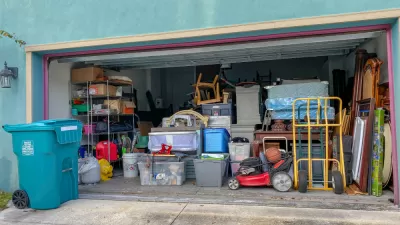
Why a Third of Private Garages Don’t House Cars
With curbside parking available for free in front of most American homes, residents with private garages often choose to utilize the space for household storage. Putting a price on street parking could change that.
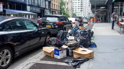
NYC Launches ‘Smart Curbs’ Program
The pilot program on the Upper West Side will remove some curbside parking spots to replace them with public seating, bike racks, and delivery zones.
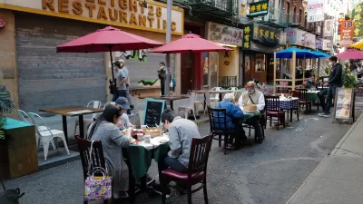
NYC Losing Many Outdoor Dining Areas Due to Expensive New Regulations
Restaurant owners say the city’s new outdoor dining program makes it too difficult and expensive to operate al fresco setups.
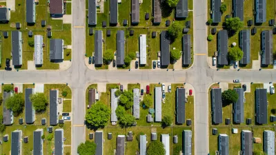
Manufactured Crisis: Losing the Nation’s Largest Source of Unsubsidized Affordable Housing
Manufactured housing communities have long been an affordable housing option for millions of people living in the U.S., but that affordability is disappearing rapidly. How did we get here?

Americans May Be Stuck — But Why?
Americans are moving a lot less than they once did, and that is a problem. While Yoni Applebaum, in his highly-publicized article Stuck, gets the reasons badly wrong, it's still important to ask: why are we moving so much less than before?

Using Old Oil and Gas Wells for Green Energy Storage
Penn State researchers have found that repurposing abandoned oil and gas wells for geothermal-assisted compressed-air energy storage can boost efficiency, reduce environmental risks, and support clean energy and job transitions.

Greening Oakland’s School Grounds
With help from community partners like the Trust for Public Land, Oakland Unified School District is turning barren, asphalt-covered schoolyards into vibrant, green spaces that support outdoor learning, play, and student well-being.

California Governor Suspends CEQA Reviews for Utilities in Fire Areas
Utility restoration efforts in areas affected by the January wildfires in Los Angeles will be exempt from environmental regulations to speed up the rebuilding of essential infrastructure.

Native American Communities Prepare to Lead on Environmental Stewardship
In the face of federal threats to public lands and conservation efforts, indigenous groups continue to model nature-centered conservation efforts.
Urban Design for Planners 1: Software Tools
This six-course series explores essential urban design concepts using open source software and equips planners with the tools they need to participate fully in the urban design process.
Planning for Universal Design
Learn the tools for implementing Universal Design in planning regulations.
Heyer Gruel & Associates PA
City of Moreno Valley
Institute for Housing and Urban Development Studies (IHS)
City of Grandview
Harvard GSD Executive Education
Salt Lake City
NYU Wagner Graduate School of Public Service
City of Cambridge, Maryland