U.S. Geological Survey

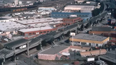
Where the Ground Sinks Under the Weight of Development
New research documents how the weight of buildings causes the ground to sink underneath developments in the San Francisco Bay Area.

Bay Area Not Prepared for Next Big One
As the death toll from Mexico's 7.1 magnitude earthquake on Sept. 19 climbs above 300, the San Francisco Chronicle investigates how well prepared the Bay Area is for an earthquake of comparable magnitude. Not very well.
Mexico City Earthquake Should Raise Questions About Building Safety
The epicenter of Tuesday's quake was in the state of Puebla, 80 miles southeast of Mexico City. Soft soil and unreinforced buildings magnified the damage. The quake comes two weeks after an 8.1 quake struck off the coast of the state of Oaxaca.

The Environmental Regulation Overturned by the New Interior Secretary on Day One
A dramatic entrance on horseback preceded one of Ryan Zinke's first actions as Secretary of the Department of Interior—rescinding guidance issued by the Fish & Wildlife Service to phase out the use of toxic, lead ammunition on federal lands.
One Geologist Predicted Floods in St. Louis Months Before They Struck
Hindsight is 20-20, but so too sometimes is the foresight of geologists. That was the case prior to the flooding that struck St. Louis this December.
Friday Eye Candy: How USGS Surveys Helped Build Pixar's New Dream World
Jody Avirgan shares insight into a new podcast with the creators of the new Pixar movie The Good Dinosaur, which reads like more of an advertisement for the U.S. Geological Survey (USGS).
Midwest Earthquakes Are Redrawing the Risk Map
Setting aside the debate about fracking's responsibility for swarms of earthquakes in states like Kansas, Texas, and Oklahoma, seismic experts are recognizing a need to rethink building safety.
The First-Ever 'Ecological Land Units' Map of the World
A new web-based tool by the U.S. Geological Survey (USGS) and Esri allows users to "explore the ecological tapestry of the world."

U.S. Water Use Hits 45-Year Low
Recent data from the United States Geological Survey (USGS) shows that the country is using less water even as its population grows.
NASA Images Depict Stunning Urban Growth
Animated GIFs provided by The Atlantic Cities show the dramatic growth of several global cities over the past four decades, as captured in photographs taken by NASA's Landsat satellite system.
Urban Design for Planners 1: Software Tools
This six-course series explores essential urban design concepts using open source software and equips planners with the tools they need to participate fully in the urban design process.
Planning for Universal Design
Learn the tools for implementing Universal Design in planning regulations.
City of Santa Clarita
Ascent Environmental
Institute for Housing and Urban Development Studies (IHS)
City of Grandview
Harvard GSD Executive Education
Toledo-Lucas County Plan Commissions
Salt Lake City
NYU Wagner Graduate School of Public Service


