


Development Patterns

Planning for Proximity, for the Climate’s Sake
A new global platform will help the world identify and encourage opportunities for more proximity in the built environment—development patterns that can help reduce sources of greenhouse gas emissions and other forms of pollution if built well.
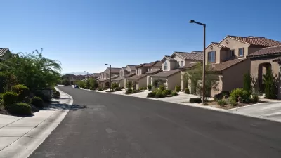
What Is a Suburb?
Another term lacking a consensus definition in the field of planning, "suburb" is usually deployed to describe residential communities outside central urban areas.

Pew: More Americans Prefer Big Homes, Longer Distances to Retail and Amenities
The pandemic has resulted in an an increasing preference for sprawl among Americans, according to the findings of a recent Pew Research Center "American Trends Panel."
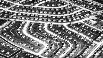
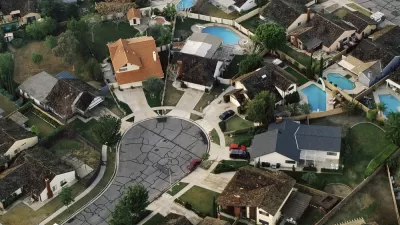
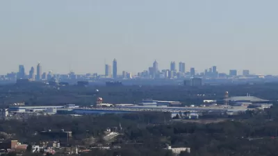
Cities in the South and West Keep Sprawling
New suburbs continue to expand into previously undeveloped areas, putting strain on local resources.

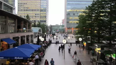
What Are Streetcar Suburbs?
Named after the mode of transportation that made their existence possible by dramatically reducing travel times, streetcar suburbs are communities located along streetcar lines farther out from city centers, on the periphery of the urban areas in the late 19th century.
On the Essential Role of Land Use in the Fight Against Climate Change
The country cannot hope to achieve its goals for the reduction of greenhouse gas emissions without fundamentally rethinking its land use and development patterns, according to this article.
How to Define the Suburban: HUD Survey Sheds New Light
A new HUD survey could help change the way the federal government defines the "suburban"—a notoriously tricky proposition.
A 'Cul-De-Tax' for the Cul-De-Sac?
A recent study studying the contemporary planning profession's rejection of the cul-de-sac includes a proposal to create more economic disincentives for inefficient street grid patterns.
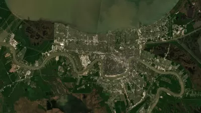
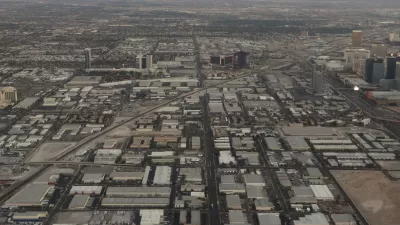
Satellite Imagery of a Decade's Transformation
Trends in land use and development are made obvious with satellite imagery tracking changes during the 2010s.
Mapped: Every Building in the United States
Using data from Microsoft, the New York Times has published an online map showing the placement of every building in the country, in a simple black and white format.
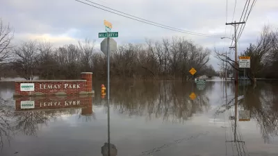
Floodplain Development Grows as Regulations Shrink
More Americans are moving to high-risk flood zones as environmental deregulation wins the day.
Mapping the World's Proximity to Urban Areas
When it's said that most people live in cities, a significant portion of that number are people living in suburbs near cities. A new map shows just how far everyone travels to get to a big city.
Track the Cycles of New York's Skyscraper Habit
Much has been made of New York's current boom in high-rise construction. A new interactive feature by the Council of Tall Buildings and Urban Habitat allows for some historic perspective on the city's penchant for building skyward.
On the Benefits of Streetcar Suburbs
Peter Saunders knows of the Corner Side Yard knows a good thing when he sees it, and that is good thing is the streetcar suburb.
On the Creative Neighborhood's Two Basic Forms
Richard Florida discusses a study comparing the neighborhoods that house "creative" industries. Science and tech tends to favor low-density office parks, while arts and cultural industries prefer mixed-use urban districts.
Urban Design for Planners 1: Software Tools
This six-course series explores essential urban design concepts using open source software and equips planners with the tools they need to participate fully in the urban design process.
Planning for Universal Design
Learn the tools for implementing Universal Design in planning regulations.
Smith Gee Studio
Alamo Area Metropolitan Planning Organization
City of Santa Clarita
Institute for Housing and Urban Development Studies (IHS)
City of Grandview
Harvard GSD Executive Education
Toledo-Lucas County Plan Commissions
Salt Lake City
NYU Wagner Graduate School of Public Service


