


Individuals and major companies alike have already found a variety of applications for the software.

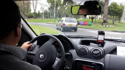
Uber has made its internal mapping software open-source and public, reports Fast Co. Design writer Katharine Schwab. Originally built to process large amounts of location data generated by Uber rides, Kepler.gl is applauded for being lightweight and easy to use, and since been adopted by companies including Mapbox, Airbnb, Sidewalk Labs, and Limebike.
Internally, Uber uses the software to steer drivers to areas with high demand for rides and to improve routing of shared rides, as well as to demonstrate the company's popularity to city officials. Other users have analyzed the refugee crisis, deforestation, and coal mines, according to a spokesperson.
The software can process up to a million data points of any type of location data. It's also browser-based, which, according to Schwab, helps prevent Uber from accessing the data uploaded by users. The tool's public release is the company's latest attempt to rehabilitate its reputation for data secrecy.
FULL STORY: Anyone can use Uber’s new map-making tool


Gig Workers Demand Data Transparency
Access to data for gig workers can provide a valuable source of information and bargaining power in a traditionally opaque and risky industry.

L.A. Wins Round One in Battle With Uber Over Privacy and Data
Los Angeles and Uber bike-share subsidiary Jump are in a protracted legal battle over the city's data sharing requirements.
Uber and Lyft Worry They'll Be Forced to Share Ride-Hailing Data After Sharing Scooter Data
A fight over the travel data of shared use mobility companies is just starting in Los Angeles.

Alabama: Trump Terminates Settlements for Black Communities Harmed By Raw Sewage
Trump deemed the landmark civil rights agreement “illegal DEI and environmental justice policy.”

Planetizen Federal Action Tracker
A weekly monitor of how Trump’s orders and actions are impacting planners and planning in America.

The 120 Year Old Tiny Home Villages That Sheltered San Francisco’s Earthquake Refugees
More than a century ago, San Francisco mobilized to house thousands of residents displaced by the 1906 earthquake. Could their strategy offer a model for the present?

In Both Crashes and Crime, Public Transportation is Far Safer than Driving
Contrary to popular assumptions, public transportation has far lower crash and crime rates than automobile travel. For safer communities, improve and encourage transit travel.

Report: Zoning Reforms Should Complement Nashville’s Ambitious Transit Plan
Without reform, restrictive zoning codes will limit the impact of the city’s planned transit expansion and could exclude some of the residents who depend on transit the most.

Judge Orders Release of Frozen IRA, IIJA Funding
The decision is a victory for environmental groups who charged that freezing funds for critical infrastructure and disaster response programs caused “real and irreparable harm” to communities.
Urban Design for Planners 1: Software Tools
This six-course series explores essential urban design concepts using open source software and equips planners with the tools they need to participate fully in the urban design process.
Planning for Universal Design
Learn the tools for implementing Universal Design in planning regulations.
Clanton & Associates, Inc.
Jessamine County Fiscal Court
Institute for Housing and Urban Development Studies (IHS)
City of Grandview
Harvard GSD Executive Education
Toledo-Lucas County Plan Commissions
Salt Lake City
NYU Wagner Graduate School of Public Service