


These days, cities are expected to make the most of open data and spatial visualization technologies.
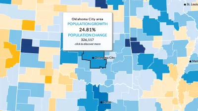
Jim Berry, a gedeveloper advocate at Esri, publishes an article at Smart Cities Dive that offers advice on how cities can better deploy GIS technology.
"There’s a revolution in civic innovation taking place in most major cities around the world, writes Berry, "cities are realizing the need to provide easy access to open spatial data and interactive map apps for partner agencies and local governments."
Beyond making the case for why cities should embrace this revolution (e.g., open data frees up workers and provides data and resources within their daily workflows), Berry lists three steps toward making the most of open data and spatial visualization tools. The first step is to make sense of the data (with easy-to-read maps). The second step is to activate the Internet of Things. Berry sites the Virginia Beach StormSense Project as an example of this approach. The third step is to enable collaboration.
Much more detail is included on each of these approaches in the article.
FULL STORY: 3 steps to make GIS part of a successful smart city


How the National Park Service Uses GIS
A new book demonstrates how the National Park Service uses GIS technology to meet its mission and showcases a selection of maps used for effectively managing national parks.

New Book Shows How Geographic Technology Tackles Global Challenges
In his new book, Jack Dangermond explores the transformative impact of GIS technology in solving global challenges through spatial data, highlighting its widespread application across sectors and its potential to design sustainable futures.

Building Healthier Communities: The Role of GIS in Park Planning
Integrating Geographic Information Systems (GIS) into park planning enhances community health by promoting physical activity, supporting mental well-being, fostering social connectedness, and addressing public health crises and climate change.

Alabama: Trump Terminates Settlements for Black Communities Harmed By Raw Sewage
Trump deemed the landmark civil rights agreement “illegal DEI and environmental justice policy.”

Study: Maui’s Plan to Convert Vacation Rentals to Long-Term Housing Could Cause Nearly $1 Billion Economic Loss
The plan would reduce visitor accommodation by 25% resulting in 1,900 jobs lost.

Planetizen Federal Action Tracker
A weekly monitor of how Trump’s orders and actions are impacting planners and planning in America.

Restoring Northern India’s Himalayan ‘Water Temples’
Thousands of centuries-old buildings protect the region’s natural springs and serve as community wells and gathering places.

Milwaukee to Double Bike Share Stations
Bublr Bikes, one of the nation’s most successful, will add 500 new e-bikes to its system.

DC Extends Application Window for Outdoor Dining Permits
District restaurants will have until the end of November to apply, but businesses with permits in rush hour parking lanes must end operations on July 31.
Urban Design for Planners 1: Software Tools
This six-course series explores essential urban design concepts using open source software and equips planners with the tools they need to participate fully in the urban design process.
Planning for Universal Design
Learn the tools for implementing Universal Design in planning regulations.
Caltrans
Smith Gee Studio
Institute for Housing and Urban Development Studies (IHS)
City of Grandview
Harvard GSD Executive Education
Toledo-Lucas County Plan Commissions
Salt Lake City
NYU Wagner Graduate School of Public Service