


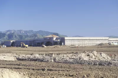
Development continues to encroach on agricultural land around the United States. A new study shows exactly how much agricultural land has been developed.
"American Farmland Trust, which since 1980 has been attempting to save agricultural land in the U.S., has compiled a huge assessment of the movement of farmland between 1992 and 2012," according to an article by Dan Nosowitz.
The "Farms Under Threat" report finds multiple causes for the decline of agricultural land, including the relatively low earnings associated with the agricultural industry and the value of the land, "especially if that farmland is near a city or town." A lack of available land for farmers is also creating an obstacle for new farmers, according to the National Young Farmers Coalition.
The article includes a list of some of the "scary" findings of the report. The headline reads that the United States lost 31 million acres of farmland to development, in total, between 1992 and 2012, which comes out to175 acres per hour, or 3 acres per minute.
FULL STORY: 10 Numbers That Show How Much Farmland We’re Losing to Development

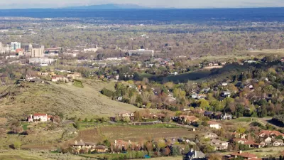
Different Approaches to Fast Growth in Idaho's Treasure Valley
Three cities on the periphery of the fast-growing Treasure Valley showcase different approaches to a sudden influx of newcomers.
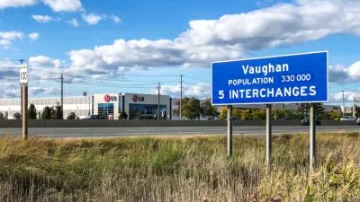
Council Votes to Allow Development on the York Region's Greenbelt
The York Regional Council took a significant step toward allowing development on a large chunk of the area's greenbelt—a move opponents say will set a dangerous precedent.
The Forgotten Treasure in Western Land
Will the arid West’s farms and settlements thrive for another century? Better conservation policy should take a longer view.

Alabama: Trump Terminates Settlements for Black Communities Harmed By Raw Sewage
Trump deemed the landmark civil rights agreement “illegal DEI and environmental justice policy.”

Planetizen Federal Action Tracker
A weekly monitor of how Trump’s orders and actions are impacting planners and planning in America.

The 120 Year Old Tiny Home Villages That Sheltered San Francisco’s Earthquake Refugees
More than a century ago, San Francisco mobilized to house thousands of residents displaced by the 1906 earthquake. Could their strategy offer a model for the present?

Ken Jennings Launches Transit Web Series
The Jeopardy champ wants you to ride public transit.

BLM To Rescind Public Lands Rule
The change will downgrade conservation, once again putting federal land at risk for mining and other extractive uses.

Indy Neighborhood Group Builds Temporary Multi-Use Path
Community members, aided in part by funding from the city, repurposed a vehicle lane to create a protected bike and pedestrian path for the summer season.
Urban Design for Planners 1: Software Tools
This six-course series explores essential urban design concepts using open source software and equips planners with the tools they need to participate fully in the urban design process.
Planning for Universal Design
Learn the tools for implementing Universal Design in planning regulations.
Clanton & Associates, Inc.
Jessamine County Fiscal Court
Institute for Housing and Urban Development Studies (IHS)
City of Grandview
Harvard GSD Executive Education
Toledo-Lucas County Plan Commissions
Salt Lake City
NYU Wagner Graduate School of Public Service