


When it's said that most people live in cities, a significant portion of that number are people living in suburbs near cities. A new map shows just how far everyone travels to get to a big city.
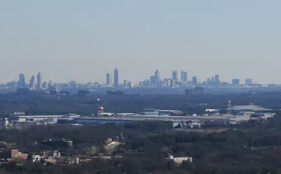
Jessica Stewart shares news of a new mapping project by the University of Oxford's Malaria Atlas Project, published by the journal Nature, by citing the oft-quoted-but-largely-misleading statistic about 50 percent of the world's population living in cities. The study's findings are more nuanced than that lede-friendly nugget: in 2015, 80.7% of all people lived within an hour of a city.
Other findings of the study including insight into the geography of poverty:
In some areas, like sub-Saharan Africa, access to the city is also a large indicator of wealth, with only 50% of people living in low-income areas residing within an hour of the city. This is in stark contrast to people living in high-income areas, as 90.7% of these individuals can reach the city in less than an hour.
The Malaria Atlas Project made its findings public as an interactive online map and data explorer.
FULL STORY: New Map Shows How Long It Takes People Around the World to Travel to the Nearest City

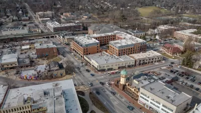
How to Define the Suburban: HUD Survey Sheds New Light
A new HUD survey could help change the way the federal government defines the "suburban"—a notoriously tricky proposition.

The Natalist Case For Sprawl (And Why It Fails)
Some commentators defend anti-urban government policies such as exclusionary zoning on the basis that homeowning suburbanites have high birth rates. But this doesn't seem to be true in recent decades.
Off-Street Parking in the Midburbs
In several New Jersey cities, eliminating parking requirements has boosted local businesses.

Alabama: Trump Terminates Settlements for Black Communities Harmed By Raw Sewage
Trump deemed the landmark civil rights agreement “illegal DEI and environmental justice policy.”

Planetizen Federal Action Tracker
A weekly monitor of how Trump’s orders and actions are impacting planners and planning in America.

The 120 Year Old Tiny Home Villages That Sheltered San Francisco’s Earthquake Refugees
More than a century ago, San Francisco mobilized to house thousands of residents displaced by the 1906 earthquake. Could their strategy offer a model for the present?

In Both Crashes and Crime, Public Transportation is Far Safer than Driving
Contrary to popular assumptions, public transportation has far lower crash and crime rates than automobile travel. For safer communities, improve and encourage transit travel.

Report: Zoning Reforms Should Complement Nashville’s Ambitious Transit Plan
Without reform, restrictive zoning codes will limit the impact of the city’s planned transit expansion and could exclude some of the residents who depend on transit the most.

Judge Orders Release of Frozen IRA, IIJA Funding
The decision is a victory for environmental groups who charged that freezing funds for critical infrastructure and disaster response programs caused “real and irreparable harm” to communities.
Urban Design for Planners 1: Software Tools
This six-course series explores essential urban design concepts using open source software and equips planners with the tools they need to participate fully in the urban design process.
Planning for Universal Design
Learn the tools for implementing Universal Design in planning regulations.
Clanton & Associates, Inc.
Jessamine County Fiscal Court
Institute for Housing and Urban Development Studies (IHS)
City of Grandview
Harvard GSD Executive Education
Toledo-Lucas County Plan Commissions
Salt Lake City
NYU Wagner Graduate School of Public Service