


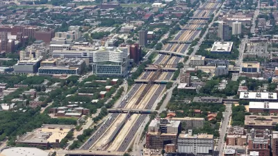
UIC architecture students competed to design improvements for the spaces under Chicago's South Side "Skyway," which carries drivers from the city to and from Northwest Indiana.
Underpasses on Chicago's South Side were the subject of a University of Illinois at Chicago contest for architecture students. Chicago's Skyway is a privately owned highway that connects northwest Indiana and Chicago. The South Chicago Chamber of Commerce and architecture firm, Urban Labs, put together an exhibition of the student's concepts.
"The purpose of last week’s meeting was to gather feedback from the community on what they would like to see occupy the 93rd and Commercial space," Maribel Quezada writes for Streetsblog Chicago.
In many of the proposals, little-loved spaces would turn into places to walk, bike or relax, enlivening the neighborhood the Skyway passes through on the southeast side of Chicago. "Under this proposal, the space would be transformed into a unique, recognizable public space that would attract and benefit multiple generations through the use of art, a garden-market, and play spaces," Quezada writes.
FULL STORY: South Chicagoans Weigh in on Plans to Activate Dead Space Under the Skyway

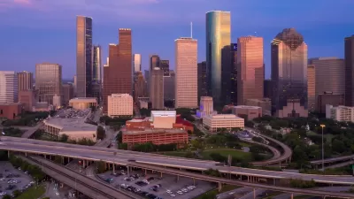
Reimagining the Space Beneath Houston’s Freeways
Opportunities abound for Houston to capitalize on otherwise unused space beneath its wide network of freeways.
Chicago Awarded $2M Reconnecting Communities Grant
Community advocates say the city’s plan may not do enough to reverse the negative impacts of a major expressway.
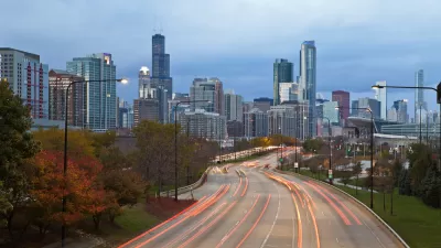
Chicago's Lake Shore Drive Renamed to Honor Black Pioneer
Introducing Jean Baptiste Point DuSable Lake Shore Drive, renamed to honor the first non-indigenous settler of Chicago.

Alabama: Trump Terminates Settlements for Black Communities Harmed By Raw Sewage
Trump deemed the landmark civil rights agreement “illegal DEI and environmental justice policy.”

Planetizen Federal Action Tracker
A weekly monitor of how Trump’s orders and actions are impacting planners and planning in America.

The 120 Year Old Tiny Home Villages That Sheltered San Francisco’s Earthquake Refugees
More than a century ago, San Francisco mobilized to house thousands of residents displaced by the 1906 earthquake. Could their strategy offer a model for the present?

Indy Neighborhood Group Builds Temporary Multi-Use Path
Community members, aided in part by funding from the city, repurposed a vehicle lane to create a protected bike and pedestrian path for the summer season.

Congestion Pricing Drops Holland Tunnel Delays by 65 Percent
New York City’s contentious tolling program has yielded improved traffic and roughly $100 million in revenue for the MTA.

In Both Crashes and Crime, Public Transportation is Far Safer than Driving
Contrary to popular assumptions, public transportation has far lower crash and crime rates than automobile travel. For safer communities, improve and encourage transit travel.
Urban Design for Planners 1: Software Tools
This six-course series explores essential urban design concepts using open source software and equips planners with the tools they need to participate fully in the urban design process.
Planning for Universal Design
Learn the tools for implementing Universal Design in planning regulations.
Clanton & Associates, Inc.
Jessamine County Fiscal Court
Institute for Housing and Urban Development Studies (IHS)
City of Grandview
Harvard GSD Executive Education
Toledo-Lucas County Plan Commissions
Salt Lake City
NYU Wagner Graduate School of Public Service