


Montgomery County, Maryland is pursuing significant changes for Downtown Bethesda. The proof is in the draft Bethesda Downtown Plan—a long-range land use plan that would allow a new approach to density.
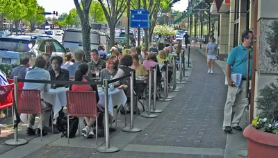
Bill Turque reports on the ongoing Bethesda Downtown Plan underway at the Montgomery County Planning Department. The goal for the new long-range land use plan for Downtown Bethesda: bring the reality of the county's public realm closer to the vision laid out by planners in a 1994 plan.
According to Torque, the current draft plan "places new emphasis on design and environmental sustainability and would require property owners to pay for parks and affordable housing to get permission to build bigger and taller — up to 29 stories along the neighborhood’s central artery."
"The hope is that the downtown Bethesda of 2035 will truly be greener, more walkable and architecturally striking," adds Turque.
Among the innovations proposed by the new plan: pooling the additional density allowed by the new plan, rather than allowing specific levels of density to each project. The plan also proposes a park impact fee, inclusionary zoning, environmental standards, and a design review process.
The Bethesda Downtown Plan is expected for its first hearing with the Montgomery County Council's Planning, Housing and Economic Development Committee in January 2017.
FULL STORY: In downtown Bethesda, residents and county debate whether more height is right

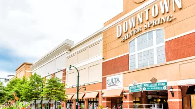
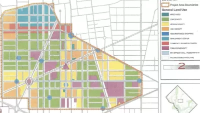
Silver Spring Downtown Plan Expanding to Make Room for the Missing Middle
Planners are hoping that by expanding the boundaries of the Silver Spring Downtown Plan in Montgomery County, Maryland, new opportunities for missing middle housing will create new opportunities for housing affordability.
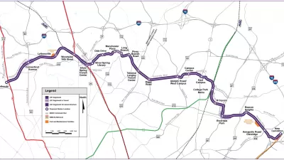
Maryland's Purple Line Clears Final Legal Obstacle
A third lawsuit tried to halt the Purple Line light rail project in Maryland, but it was just the latest lawsuit to get tossed by a judge.
The Days of Two Remaining D.C. Urban Renewal Plans Could Be Numbered
Urban renewal plans for Downtown D.C. and the Shaw neighborhood are all that's left of a mid-20th-century planning effort.

Alabama: Trump Terminates Settlements for Black Communities Harmed By Raw Sewage
Trump deemed the landmark civil rights agreement “illegal DEI and environmental justice policy.”

Planetizen Federal Action Tracker
A weekly monitor of how Trump’s orders and actions are impacting planners and planning in America.

The 120 Year Old Tiny Home Villages That Sheltered San Francisco’s Earthquake Refugees
More than a century ago, San Francisco mobilized to house thousands of residents displaced by the 1906 earthquake. Could their strategy offer a model for the present?

Ken Jennings Launches Transit Web Series
The Jeopardy champ wants you to ride public transit.

BLM To Rescind Public Lands Rule
The change will downgrade conservation, once again putting federal land at risk for mining and other extractive uses.

Indy Neighborhood Group Builds Temporary Multi-Use Path
Community members, aided in part by funding from the city, repurposed a vehicle lane to create a protected bike and pedestrian path for the summer season.
Urban Design for Planners 1: Software Tools
This six-course series explores essential urban design concepts using open source software and equips planners with the tools they need to participate fully in the urban design process.
Planning for Universal Design
Learn the tools for implementing Universal Design in planning regulations.
Clanton & Associates, Inc.
Jessamine County Fiscal Court
Institute for Housing and Urban Development Studies (IHS)
City of Grandview
Harvard GSD Executive Education
Toledo-Lucas County Plan Commissions
Salt Lake City
NYU Wagner Graduate School of Public Service