


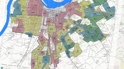
The Mapping Inequality website documents how the liberal ideals of the New Deal devolved into discrimination and inequality.
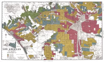
"The maps in this post are part of a grim history," according to an article by Greg Miller. "They were created by a government program in the 1930s and played a role in keeping African Americans and other minorities from owning property in American cities, thereby leaving an indelible mark on the racial and economic history of the United States."
The Mapping Inequality project has gathered these maps and documents, the work of the Home Owners' Loan Corporation (HOLC) during the Great Depression, and placed them online.
Miller explains more of the redlining history of the HOLC, while also sampling specific case studies from cities included in the Mapping Inequality archive—cities such as Los Angeles, Seattle, Wichita, and Portland.
As acknowledged on the Mapping Inequality website, the project combines the work of researchers and students at the University of Richmond, the University of Maryland, Virginia Tech, and Johns Hopkins University.
FULL STORY: Newly Released Maps Show How Housing Discrimination Happened

Reporters Go Undercover to Identify Housing Discrimination
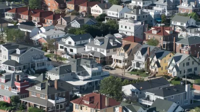
A three-year investigation of the real estate industry on Long Island reveals rampant discriminatory practices and an industry complicit in the segregation of the communities that comprise the region.
Study: Historical Redlining Maps No Longer a Proxy for Black America
Black Americans have moved on from formerly redlined neighborhoods, and other minorities and whites have moved in. The wave of presidential campaigns that have based housing policy proposals on redlining maps might be misguided as a result.
Seattle Exhibit Grapples With Redlining Past and Present
A creative exhibit highlights how redlining and racist exclusion persist today.

Alabama: Trump Terminates Settlements for Black Communities Harmed By Raw Sewage
Trump deemed the landmark civil rights agreement “illegal DEI and environmental justice policy.”

Planetizen Federal Action Tracker
A weekly monitor of how Trump’s orders and actions are impacting planners and planning in America.

The 120 Year Old Tiny Home Villages That Sheltered San Francisco’s Earthquake Refugees
More than a century ago, San Francisco mobilized to house thousands of residents displaced by the 1906 earthquake. Could their strategy offer a model for the present?

Ken Jennings Launches Transit Web Series
The Jeopardy champ wants you to ride public transit.

BLM To Rescind Public Lands Rule
The change will downgrade conservation, once again putting federal land at risk for mining and other extractive uses.

Indy Neighborhood Group Builds Temporary Multi-Use Path
Community members, aided in part by funding from the city, repurposed a vehicle lane to create a protected bike and pedestrian path for the summer season.
Urban Design for Planners 1: Software Tools
This six-course series explores essential urban design concepts using open source software and equips planners with the tools they need to participate fully in the urban design process.
Planning for Universal Design
Learn the tools for implementing Universal Design in planning regulations.
Clanton & Associates, Inc.
Jessamine County Fiscal Court
Institute for Housing and Urban Development Studies (IHS)
City of Grandview
Harvard GSD Executive Education
Toledo-Lucas County Plan Commissions
Salt Lake City
NYU Wagner Graduate School of Public Service