


California wants the region to work together to deal with the impacts of climate change.
Over the next three years, state officials will draft a plan to help the Bay Area prepare its communities and infrastructure for the risks of sea-level rise to local. A 2012 study found that by the year 2100, daily tides could reach up to 66 inches higher than today.
The San Francisco Bay Conservation and Development Commission, a state agency, will partner with Caltrans and the Metropolitan Transportation Commission on the plan, recommending that local governments also collaborate on climate change adaptation efforts.
Work will begin with the completion of "vulnerability assessments" for areas along the shoreline, focusing particularly on major roads, rail corridors, and "communities with characteristics that make them more vulnerable to sea level rise," according to the San Francisco Chronicle.
The Commission originally agreed to pursue an adaptation strategy four months ago.
FULL STORY: State agency to draw up plan for sea level rise in Bay Area

Bay Area's First Climate Adaptation Project Could Be a North Bay Highway
State Route 37 is a vital highway connecting four North Bay counties plagued by two unrelated problems: chronic flooding during high tides and traffic congestion. Fixing the problem will set a precedent for Bay Area climate adaptation.
How US Cities Can Prepare for Climate Disasters
Resilience, encompassing infrastructure, governance, economic strength, and social cohesion, is critical for cities to mitigate rising climate risks like flooding, wildfires, and heat, ensuring long-term recovery and adaptability.
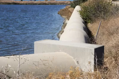
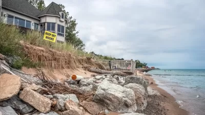
Climate Change Putting Coastal Infrastructure at Risk
More than 1,000 coastal facilities could flood as often as once a month as sea levels rise, according to a study from the Union of Concerned Scientists.

Alabama: Trump Terminates Settlements for Black Communities Harmed By Raw Sewage
Trump deemed the landmark civil rights agreement “illegal DEI and environmental justice policy.”

Planetizen Federal Action Tracker
A weekly monitor of how Trump’s orders and actions are impacting planners and planning in America.

The 120 Year Old Tiny Home Villages That Sheltered San Francisco’s Earthquake Refugees
More than a century ago, San Francisco mobilized to house thousands of residents displaced by the 1906 earthquake. Could their strategy offer a model for the present?

Ken Jennings Launches Transit Web Series
The Jeopardy champ wants you to ride public transit.

BLM To Rescind Public Lands Rule
The change will downgrade conservation, once again putting federal land at risk for mining and other extractive uses.

Indy Neighborhood Group Builds Temporary Multi-Use Path
Community members, aided in part by funding from the city, repurposed a vehicle lane to create a protected bike and pedestrian path for the summer season.
Urban Design for Planners 1: Software Tools
This six-course series explores essential urban design concepts using open source software and equips planners with the tools they need to participate fully in the urban design process.
Planning for Universal Design
Learn the tools for implementing Universal Design in planning regulations.
Clanton & Associates, Inc.
Jessamine County Fiscal Court
Institute for Housing and Urban Development Studies (IHS)
City of Grandview
Harvard GSD Executive Education
Toledo-Lucas County Plan Commissions
Salt Lake City
NYU Wagner Graduate School of Public Service