


A new online mapping project called American Panorama earned rave reviews this week from CityLab and Gizmodo.
Writing for CityLab, Laura Bliss describes the ambition of the American Panorama project, as conceived by a collaboration between the University of Richmond's Digital Scholarship Lab and the cartography firm Stamen. Though the maps are specifically designed to look contemporary, according to Bliss, " these are not the simple animated maps or hover-over statistical visualizations to which Internet trawlers are by now so accustomed. The Panorama’s plates are dense, like entire textbook chapters turned interactive tools."
Bliss goes on to focus on two of the project's maps (the project's website promises more in the future): "Foreign-Born Population: A Nation of Overlapping Diasporas" and "Forced Migration of Enslaved People."
Writing for Gizmodo, Alissa Walker also focused on the former of those two maps in addition to a map of overland trails showing how pioneers settled the American West. Walker also provides this effusive review: "This is data storytelling at its very finest and I’m really looking forward to seeing what other topics American Panorama covers."
FULL STORY: A Historical Atlas of America, Built for the 21st Century


How Digital Mapping Can Reinforce Inequity
Digital mapping tools like Google Street View often obscure the realities of cities and concentrate their resources in the wealthiest countries, effectively ‘erasing’ some places from the global map.

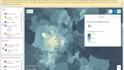
New Interactive Mapping Tool Tracks all of NYC's Infrastructure Projects, Housing Permits, and City Facilities
The New York Department of City Planning has taken its open data practices to a new level with the launch of the Capital Planning Explorer.
Smart Growth Loves Heatmaps
Smart growth can provide many important benefits that are easy to see using informative and beautiful heatmaps—our complex world as viewed by all-knowing gods.

Alabama: Trump Terminates Settlements for Black Communities Harmed By Raw Sewage
Trump deemed the landmark civil rights agreement “illegal DEI and environmental justice policy.”

Planetizen Federal Action Tracker
A weekly monitor of how Trump’s orders and actions are impacting planners and planning in America.

The 120 Year Old Tiny Home Villages That Sheltered San Francisco’s Earthquake Refugees
More than a century ago, San Francisco mobilized to house thousands of residents displaced by the 1906 earthquake. Could their strategy offer a model for the present?

San Francisco Opens Park on Former Great Highway
The Sunset Dunes park’s grand opening attracted both fans and detractors.

Oregon Legislature to Consider Transit Funding Laws
One proposal would increase the state’s payroll tax by .08% to fund transit agencies and expand service.

Housing Vouchers as a Key Piece of Houston’s Housing Strategy
The Houston Housing Authority supports 19,000 households through the housing voucher program.
Urban Design for Planners 1: Software Tools
This six-course series explores essential urban design concepts using open source software and equips planners with the tools they need to participate fully in the urban design process.
Planning for Universal Design
Learn the tools for implementing Universal Design in planning regulations.
Clanton & Associates, Inc.
Jessamine County Fiscal Court
Institute for Housing and Urban Development Studies (IHS)
City of Grandview
Harvard GSD Executive Education
Toledo-Lucas County Plan Commissions
Salt Lake City
NYU Wagner Graduate School of Public Service