


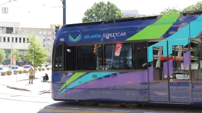
The transit map is being redrawn in Atlanta.
"The Atlanta City Council has approved a new Streetcar System Plan, which includes five crosstown routes in addition to 22 miles of streetcar service along the Beltline," reports Andria Simmons.
The plan will guide a system totaling 50-plus miles of streetcar routes throughout the city. One major hurdle left to clear before the plan can begin moving toward reality: a 2016 Fulton County referendum that will ask voters "to impose an additional penny or fractional penny sales tax to fund transportation projects."
The Atlanta Streetcar System Plan, as it's called, will serve as a framework for the county referendum as well as for potential federal funding.
The article includes some details of the council hearing that produced the plan's approval, as well as a round of reaction soundbites from politicians both supporting and opposing the project.
FULL STORY: Atlanta approves Streetcar expansion plan

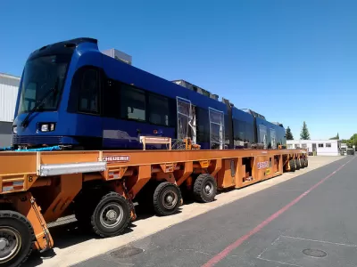
Atlanta Looks to Expand New Streetcar Line
With Atlanta's first new streetcar line in a century set to be completed next year, transit advocates are putting recent defeats behind them and studying how to expand the system.
Atlanta Changes Beltline Rail Plan
City officials say they are committed to building rail connections, but are nixing a prior plan to extend the streetcar network.
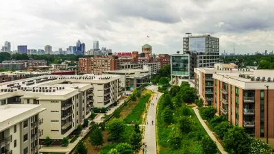
Beltline Surpasses Annual Affordable Housing Goal
The Atlanta Beltline agency is actively working to prevent the displacement of longtime residents along the trail system, where property values are rising rapidly.

Alabama: Trump Terminates Settlements for Black Communities Harmed By Raw Sewage
Trump deemed the landmark civil rights agreement “illegal DEI and environmental justice policy.”

Planetizen Federal Action Tracker
A weekly monitor of how Trump’s orders and actions are impacting planners and planning in America.

The 120 Year Old Tiny Home Villages That Sheltered San Francisco’s Earthquake Refugees
More than a century ago, San Francisco mobilized to house thousands of residents displaced by the 1906 earthquake. Could their strategy offer a model for the present?

Indy Neighborhood Group Builds Temporary Multi-Use Path
Community members, aided in part by funding from the city, repurposed a vehicle lane to create a protected bike and pedestrian path for the summer season.

Congestion Pricing Drops Holland Tunnel Delays by 65 Percent
New York City’s contentious tolling program has yielded improved traffic and roughly $100 million in revenue for the MTA.

In Both Crashes and Crime, Public Transportation is Far Safer than Driving
Contrary to popular assumptions, public transportation has far lower crash and crime rates than automobile travel. For safer communities, improve and encourage transit travel.
Urban Design for Planners 1: Software Tools
This six-course series explores essential urban design concepts using open source software and equips planners with the tools they need to participate fully in the urban design process.
Planning for Universal Design
Learn the tools for implementing Universal Design in planning regulations.
Clanton & Associates, Inc.
Jessamine County Fiscal Court
Institute for Housing and Urban Development Studies (IHS)
City of Grandview
Harvard GSD Executive Education
Toledo-Lucas County Plan Commissions
Salt Lake City
NYU Wagner Graduate School of Public Service