


An intrepid mapmaker and data cruncher has created a map that illustrates the ubiquity of fatalities on U.S. roads and highways.
Max Galka gathered the data from the U.S. Department of Transportation's Fatality Analysis Reporting System (FARS) into an interactive map that shows "373,377 points, one for each person who died in a vehicle crash between 2004 and 2013."
Each of the icons on the mapping representing data points also shows more information about the crash—i.e., whether the victim was a driver, passenger, or pedestrian, for instance. "Optionally, the map allows you to highlight crashes by contributing factor: alcohol, speeding, or distracted driving (using the Dept of Transportation’s definition)," adds Galka.
The map is an example of the democratic power of new mapping and data tools. Max Galka runs the Metrocosm website and created the map by himself, but people all over the country are picking up the story and sharing it online.
FULL STORY: Every Death on Every U.S. Road 2004-2013

Report: Racial Gap in Traffic Deaths Persists
Communities of color have significantly higher rates of traffic fatalities, according to federal research.

Acceptable Deaths
What can we learn from our Covid response?
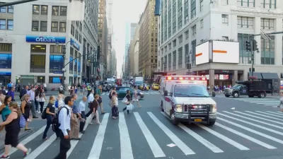
New York City Traffic Fatalities Pass 2019 Totals
The visions of a car-free utopia that might have seemed like a potential silver lining in March and April have given away to a tragic reality.

Alabama: Trump Terminates Settlements for Black Communities Harmed By Raw Sewage
Trump deemed the landmark civil rights agreement “illegal DEI and environmental justice policy.”

Planetizen Federal Action Tracker
A weekly monitor of how Trump’s orders and actions are impacting planners and planning in America.

The 120 Year Old Tiny Home Villages That Sheltered San Francisco’s Earthquake Refugees
More than a century ago, San Francisco mobilized to house thousands of residents displaced by the 1906 earthquake. Could their strategy offer a model for the present?

Opinion: California’s SB 79 Would Improve Housing Affordability and Transit Access
A proposed bill would legalize transit-oriented development statewide.

Record Temperatures Prompt Push for Environmental Justice Bills
Nevada legislators are proposing laws that would mandate heat mitigation measures to protect residents from the impacts of extreme heat.

Downtown Pittsburgh Set to Gain 1,300 New Housing Units
Pittsburgh’s office buildings, many of which date back to the early 20th century, are prime candidates for conversion to housing.
Urban Design for Planners 1: Software Tools
This six-course series explores essential urban design concepts using open source software and equips planners with the tools they need to participate fully in the urban design process.
Planning for Universal Design
Learn the tools for implementing Universal Design in planning regulations.
Clanton & Associates, Inc.
Jessamine County Fiscal Court
Institute for Housing and Urban Development Studies (IHS)
City of Grandview
Harvard GSD Executive Education
Toledo-Lucas County Plan Commissions
Salt Lake City
NYU Wagner Graduate School of Public Service