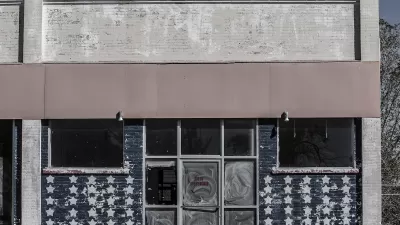
Surveying the 373 square miles, or 238,720 acres, under jurisdiction of Plan Charlotte to see how much of it is zoned for mixed-use.
Jacob Schmidt details a recent study by Plan Charlotte that quantified "how much of the city today is actually zoned for mixed-use development, compared to more conventional zoning allowing only one use, such as single-family homes, multifamily homes, office, shopping center, industry, etc.," given that mixed-use development is a stated goal of the city's 2003 General Development Policies.
The conclusion of the survey: "The analysis shows that 91 percent of the land in Charlotte—343 square miles of the total 373 square miles—is zoned for single-use. Mixed-use zoning covers only 9 percent." Schmidt adds: "Not surprisingly given the city’s low-density character, 66 percent of the single-use-zoned land is zoned for single-family housing," and "At a distant second, at 15 percent, was land zoned for industrial use. Third place was business with 8 percent; this includes land zoned for office space, commercial centers and retail."
As for why the city gives such prevalence to single uses, Schmidt writes:
"The comparative dearth of mixed-use zoning reflects both history and custom. Charlotte’s first zoning ordinance in 1947 followed national trends (and federal government requirements), carving out separate areas for single-family, multifamily, business and industrial land uses. It wasn’t until the end of the 20th century that planners in Charlotte and elsewhere began putting more emphasis on encouraging mixed-use development, and some developers began attempting to build it."
FULL STORY: Charlotte’s goal is to mix uses, but change is slow on the ground

Alabama: Trump Terminates Settlements for Black Communities Harmed By Raw Sewage
Trump deemed the landmark civil rights agreement “illegal DEI and environmental justice policy.”

Planetizen Federal Action Tracker
A weekly monitor of how Trump’s orders and actions are impacting planners and planning in America.

The 120 Year Old Tiny Home Villages That Sheltered San Francisco’s Earthquake Refugees
More than a century ago, San Francisco mobilized to house thousands of residents displaced by the 1906 earthquake. Could their strategy offer a model for the present?

High-Speed Rail Tracker
Smart Cities Dive follows high-speed rail developments around the country

Ken Jennings Launches Transit Web Series
The Jeopardy champ wants you to ride public transit.

BLM To Rescind Public Lands Rule
The change will downgrade conservation, once again putting federal land at risk for mining and other extractive uses.
Urban Design for Planners 1: Software Tools
This six-course series explores essential urban design concepts using open source software and equips planners with the tools they need to participate fully in the urban design process.
Planning for Universal Design
Learn the tools for implementing Universal Design in planning regulations.
Clanton & Associates, Inc.
Jessamine County Fiscal Court
Institute for Housing and Urban Development Studies (IHS)
City of Grandview
Harvard GSD Executive Education
Toledo-Lucas County Plan Commissions
Salt Lake City
NYU Wagner Graduate School of Public Service


