


A quick look at a real-time map of air pollution around the world shows how much healthier the air in the United States is than in China.
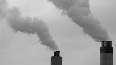
Linda Poon shares news about a new interactive tool that tracks air pollution in cities around the world in real time.
"The map comes from Beijing-based environmental group Air Quality Index China, which worked with environmental protection agencies in more than 70 countries. It continuously collects data from more than 5,900 feeds coming from more than 8,000 air-quality-monitoring stations in nearly a thousand cities. Only feeds from government agencies are used, according to the website (“no DIY or amateur monitoring stations data” here). The map refreshes every 15 minutes."
Using the data available on the map, Poon points out the huge disparity in air quality between China and the United States, for instance, as well as more detail about air quality in the United States. For instance, at the time of Poon's research of the tool, Buffalo, New York was exhibiting the worst air quality in the country.
FULL STORY: Mapping the World's Air Pollution in Real Time

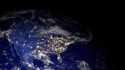
Mapping the Trends in Pollution
Good news for the United States is found in a recent series of maps by NASA. Air pollution has significantly improved around the country.
Interactive Map Documents Road Quality
A new interactive map shows wear-and-tear on city roads, color-coding where work needs to be done and where smooth rides can be found.
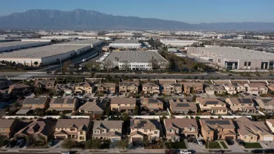
New California Law Regulates Warehouse Pollution
A new law tightens building and emissions regulations for large distribution warehouses to mitigate air pollution and traffic in surrounding communities.

Alabama: Trump Terminates Settlements for Black Communities Harmed By Raw Sewage
Trump deemed the landmark civil rights agreement “illegal DEI and environmental justice policy.”

Planetizen Federal Action Tracker
A weekly monitor of how Trump’s orders and actions are impacting planners and planning in America.

The 120 Year Old Tiny Home Villages That Sheltered San Francisco’s Earthquake Refugees
More than a century ago, San Francisco mobilized to house thousands of residents displaced by the 1906 earthquake. Could their strategy offer a model for the present?

Ken Jennings Launches Transit Web Series
The Jeopardy champ wants you to ride public transit.

BLM To Rescind Public Lands Rule
The change will downgrade conservation, once again putting federal land at risk for mining and other extractive uses.

Indy Neighborhood Group Builds Temporary Multi-Use Path
Community members, aided in part by funding from the city, repurposed a vehicle lane to create a protected bike and pedestrian path for the summer season.
Urban Design for Planners 1: Software Tools
This six-course series explores essential urban design concepts using open source software and equips planners with the tools they need to participate fully in the urban design process.
Planning for Universal Design
Learn the tools for implementing Universal Design in planning regulations.
Clanton & Associates, Inc.
Jessamine County Fiscal Court
Institute for Housing and Urban Development Studies (IHS)
City of Grandview
Harvard GSD Executive Education
Toledo-Lucas County Plan Commissions
Salt Lake City
NYU Wagner Graduate School of Public Service