


In the ongoing quest to better measure the use of streets by all modes—a new tool could be a game changer for transportation engineers, planners, and advocates alike.
Tanya Snyder reports: "A new digital tool called Placemeter aims to measure streets at a much more fine-grained level, analyzing a variety of different aspects of movement in an urban environment."
"Placemeter’s software extracts information from video of streets — it can measure the movement of vehicles, bicyclists, and pedestrians and then tell you about things like the incidence of speeding or the foot traffic for a specific storefront. Cities are finding lots of interesting ways to use it — but it’s not just for bureaucrats. The people behind Placemeter think it will be very useful for advocates too."
The article includes an interview with Alexandre Winter and Florent Peyre, founders of Placemeter, who explain the method of the new tool and its many possible applications. For additional introduction to Placemeter, there's the video found below.
Placemeter Algorithms Output from Placemeter on Vimeo.
FULL STORY: Can a New Way to Measure Streets Help Advocates Tame Speeding?

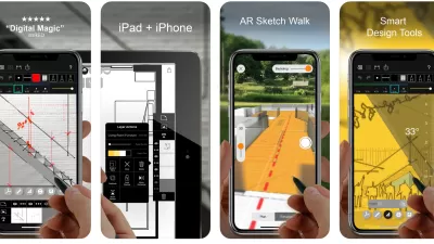
Best Apps for Urban Planning in 2022
Mobile apps continue to redefine the practices of planning—urban planning, regional planning, transportation planning, community planning, and rural planning included.
The Right Planning Consultant Could Make All of the Difference
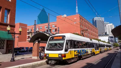
Between DART service optimization and deciding the fate of I-345, Dallas has big of decisions to make. The right consultant, who understands accurate framing of planning issues, could help choose a route that best serves Dallasites.
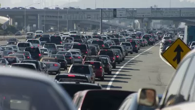
Failing to Account for Induced Traffic, Even When the Public Demands It
Induced traffic occurs when new highway capacity speeds up traffic, allowing travelers to drive further, increasing sprawl. A review of major highway project plans finds that most fail to accurately account for induced travel effects.

Alabama: Trump Terminates Settlements for Black Communities Harmed By Raw Sewage
Trump deemed the landmark civil rights agreement “illegal DEI and environmental justice policy.”

Planetizen Federal Action Tracker
A weekly monitor of how Trump’s orders and actions are impacting planners and planning in America.

The 120 Year Old Tiny Home Villages That Sheltered San Francisco’s Earthquake Refugees
More than a century ago, San Francisco mobilized to house thousands of residents displaced by the 1906 earthquake. Could their strategy offer a model for the present?

Ken Jennings Launches Transit Web Series
The Jeopardy champ wants you to ride public transit.

BLM To Rescind Public Lands Rule
The change will downgrade conservation, once again putting federal land at risk for mining and other extractive uses.

Indy Neighborhood Group Builds Temporary Multi-Use Path
Community members, aided in part by funding from the city, repurposed a vehicle lane to create a protected bike and pedestrian path for the summer season.
Urban Design for Planners 1: Software Tools
This six-course series explores essential urban design concepts using open source software and equips planners with the tools they need to participate fully in the urban design process.
Planning for Universal Design
Learn the tools for implementing Universal Design in planning regulations.
Clanton & Associates, Inc.
Jessamine County Fiscal Court
Institute for Housing and Urban Development Studies (IHS)
City of Grandview
Harvard GSD Executive Education
Toledo-Lucas County Plan Commissions
Salt Lake City
NYU Wagner Graduate School of Public Service