


Leading a walking tour of your neighborhood can be easy if you focus on the basic differences between types of neighborhoods.

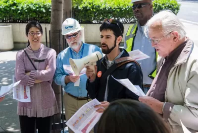
Today, I led my first Jane's Walk. Jane's Walk (named after Jane Jacobs) is an international movement of walking tours, usually held in the first week of May. In case some of you are thinking of getting involved next year, I am writing to show how you can lead a walk without an enormous amount of research.
I chose to lead a walk in Brookside, my current neighborhood in Kansas City, Missouri (where I am finishing up a one-year visitorship at the University of Missouri at Kansas City’s school of law). Since I haven't lived in Kansas City long enough to be an expert on neighborhood history, I chose to focus on Brookside as an example of a streetcar suburb—that is, a neighborhood, usually built between 1900 and 1930, that is more walkable than postwar suburbia but not quite as dense as urban parts of New York or Chicago. I hoped to show how Brookside differs both from more downtowns and from sprawling suburbs.
I began in the neighborhood's richest residential blocks; I pointed out one major differences between these blocks and newer suburbs. Brookside has a grid of short, interconnected streets; north-south streets are about 400 feet long, one-third the length of some suburban streets. (East-west streets are somewhat longer). As a result, pedestrians have many different options, and can reach a residential street without having to walk out of their way or spend unnecessary time on a busier street.
By contrast, in a suburb dominated by long blocks and cul-de-sacs, a pedestrian may have to go out of their way to reach a destination. For example, if I am in the 700 block of street X and want to visit the 1100 block of parallel street Y, but the next intersection of X is on the 1300 block, I will have to go several blocks out of my way, walking six blocks (and then somehow backtracking two more), when in Brookside I could have just walked four blocks on X and turned at the intersection. (I should have mentioned, but did not, that street grids are especially useful for bikers, who can avoid the busiest streets more easily than in neighborhoods where regional traffic is forced onto a few major arterials.)
I also noted in passing that Brookside has enormous street trees; to be fair, trees are not unknown in suburbia, but because Brookside is a few decades older than postwar suburbs, its tree canopy is more luxurious.
Then I went to Brookside’s commercial area, and noted two major differences between this block and the most extreme examples of postwar sprawl. First, Brookside shops are right in front of sidewalks, so pedestrians don’t need to cross through large parking lots in order to get to shops. Second, Brookside has some on-street parking, which benefits pedestrians in two ways: first, parked cars narrow the street and slow traffic. Second, parked cars create a buffer between sidewalks and pedestrians, thus making it easier for pedestrians to cross and harder for cars to jump curbs and kill pedestrians.
Finally, I went to the neighborhood's less luxurious blocks, and pointed out one way in which Brookside is more suburban: the separation of uses. At certain streets, commerce ends abruptly, and single-family homes take its place. By contrast, in a more urban environment, housing (especially multifamily housing) is often on the same block as, and sometimes even right above, businesses.
In sum, to run a successful walk of a streetcar suburb like Brookside, you need only focus on the key differences between such a neighborhood and suburbia (such as grid streets, short blocks, shops in front of sidewalks). If you can add a little history or culture, so much the better. If you want to try your hand at this next spring, go to the Jane's Walk website (janeswalk.org) and contact the Jane's Walk staff.


A Brief History of Kansas City’s Microtransit
The city’s costly experiment with on-demand transit is yielding to more strategic investment.
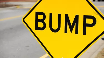
Kansas City Adding Speed Bumps for Traffic Safety
The city is adding the traffic calming measures at 50 high-risk intersections.
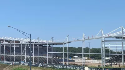
New Kansas City Stadium Offers Limited Parking
Unlike many sports arenas surrounded by seas of concrete, the new CPKC Stadium has parking for just 2,000 vehicles, hoping most sports fans will arrive by transit.

Alabama: Trump Terminates Settlements for Black Communities Harmed By Raw Sewage
Trump deemed the landmark civil rights agreement “illegal DEI and environmental justice policy.”

Planetizen Federal Action Tracker
A weekly monitor of how Trump’s orders and actions are impacting planners and planning in America.

The 120 Year Old Tiny Home Villages That Sheltered San Francisco’s Earthquake Refugees
More than a century ago, San Francisco mobilized to house thousands of residents displaced by the 1906 earthquake. Could their strategy offer a model for the present?

Opinion: California’s SB 79 Would Improve Housing Affordability and Transit Access
A proposed bill would legalize transit-oriented development statewide.

Record Temperatures Prompt Push for Environmental Justice Bills
Nevada legislators are proposing laws that would mandate heat mitigation measures to protect residents from the impacts of extreme heat.

Downtown Pittsburgh Set to Gain 1,300 New Housing Units
Pittsburgh’s office buildings, many of which date back to the early 20th century, are prime candidates for conversion to housing.
Urban Design for Planners 1: Software Tools
This six-course series explores essential urban design concepts using open source software and equips planners with the tools they need to participate fully in the urban design process.
Planning for Universal Design
Learn the tools for implementing Universal Design in planning regulations.
Clanton & Associates, Inc.
Jessamine County Fiscal Court
Institute for Housing and Urban Development Studies (IHS)
City of Grandview
Harvard GSD Executive Education
Toledo-Lucas County Plan Commissions
Salt Lake City
NYU Wagner Graduate School of Public Service