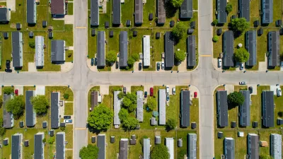
Satellite data and new software helps predict, locate, and observe fire outbreaks.
"The Wildfire Automated Biomass Burning Algorithm (WFABBA) [is] created by NOAA at the University of Wisconsin Space Science and Engineering Center in Madison, Wis. ...This program takes the feeds from...satellites to generate fire data for the entire Western Hemisphere every 30 minutes. Ground station computers take that data...to send out in map form to emergency personnel within 60 minutes of transmitted...The WFABBA software was developed by the University of Wisconsin to run on portable Linux personal computers...When combined with related weather and topographical information, the program's sophisticated statistical method identifies fires automatically..."
Thanks to Abhijeet Chavan
FULL STORY: New Software Helps Satellites Pinpoint Fires Earlier

Manufactured Crisis: Losing the Nation’s Largest Source of Unsubsidized Affordable Housing
Manufactured housing communities have long been an affordable housing option for millions of people living in the U.S., but that affordability is disappearing rapidly. How did we get here?

Americans May Be Stuck — But Why?
Americans are moving a lot less than they once did, and that is a problem. While Yoni Applebaum, in his highly-publicized article Stuck, gets the reasons badly wrong, it's still important to ask: why are we moving so much less than before?

Using Old Oil and Gas Wells for Green Energy Storage
Penn State researchers have found that repurposing abandoned oil and gas wells for geothermal-assisted compressed-air energy storage can boost efficiency, reduce environmental risks, and support clean energy and job transitions.

Greening Oakland’s School Grounds
With help from community partners like the Trust for Public Land, Oakland Unified School District is turning barren, asphalt-covered schoolyards into vibrant, green spaces that support outdoor learning, play, and student well-being.

California Governor Suspends CEQA Reviews for Utilities in Fire Areas
Utility restoration efforts in areas affected by the January wildfires in Los Angeles will be exempt from environmental regulations to speed up the rebuilding of essential infrastructure.

Native American Communities Prepare to Lead on Environmental Stewardship
In the face of federal threats to public lands and conservation efforts, indigenous groups continue to model nature-centered conservation efforts.
Urban Design for Planners 1: Software Tools
This six-course series explores essential urban design concepts using open source software and equips planners with the tools they need to participate fully in the urban design process.
Planning for Universal Design
Learn the tools for implementing Universal Design in planning regulations.
Heyer Gruel & Associates PA
City of Moreno Valley
Institute for Housing and Urban Development Studies (IHS)
City of Grandview
Harvard GSD Executive Education
Salt Lake City
NYU Wagner Graduate School of Public Service
City of Cambridge, Maryland


