


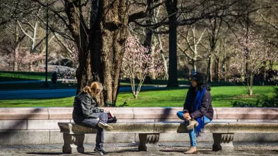
The most transit-oriented metro areas often have lower levels of traffic congestion than one might expect based on their size.


A few weeks ago, Wendell Cox wrote a blog post asserting that the most dense metros tend to have the highest levels of congestion. Assuming for the sake of argument that his methodology for measuring congestion makes sense, it does not necessarily follow that sprawl equals low congestion, or that transit-oriented development equals high congestion.
Cox focuses on metrowide density. But there are different kinds of density; some regions, such as Los Angeles, have high regionwide density but so-so transit systems, car-oriented street design, and a not-too-dense central city. Others, such as Boston, combine a very dense, transit-oriented core with not-so-dense suburbs. Regions in the first group tend to have low transit ridership, thus effectively combining density and sprawl. In addition, large regions are likely to have higher congestion than small regions, even leaving aside density.
So I thought I would take a look at Cox's data and ask a slightly different question: do transit-oriented places have more congestion than one might expect for their size, or less?
Exhibit A is New York City: the region with the highest transit ridership in the United States. Since New York is the largest region in the nation, one might expect it to have high levels of congestion. But according to Cox, New York is only fourth in congestion. Thus, it appears that a highly dense core, when combined with less-dense suburbs, will have levels of congestion lower than one might expect based on population.
Five other large regions (Philadelphia, Chicago, Boston, San Francisco, and Washington) have highly transit-oriented central cities: that is, cities where over 25 percent of residents use transit to get to work. All of these cities have fairly high central-core density; all but one (Washington) that is, over 10,000 people per square mile within the city limits, and Washington is pretty close to the 10,000/square mile mark.* In fact, five of these cities (all but Washington) are the five most dense principal cities (that is, largest city in their metropolitan area) in the United States.
Philadelphia has the fifth highest regional population, but only the thirteenth highest level of congestion. Thus, Philadelphia clearly outperforms its population in addressing traffic congestion—that is, it has less congestion than one might expect from its size.
Chicago has the third highest regional population, but only the 12th highest level of congestion. Thus, Chicago again outperforms expectations.
On the other hand, two other transit-oriented regions do not outperform. Boston has the tenth highest population but the eighth highest level of congestion, and San Francisco has the eleventh highest population but the third highest level of congestion. (Washington ranks no. 7 in both).
On balance, transit-oriented regions do not seem to have more traffic congestion, controlling for size, than the nation as a whole.
*Washington has 61 square miles and 602,000 people, according to the 2010 Census.


Large Cities Were Already Losing Population. Then Came the Coronavirus.
"Cities of all sizes may soon look less alluring, if drastic drops in income, sales and tourism tax revenue leave gaping holes in budgets," according to this article, which encapsulates a popular school of thought as the pandemic rages.
How Cities and Communities Can Rebound From the Pandemic
An interview with Michael Berkowitz, former executive director of 100 Resilient Cities, finds a path to the light at the end of the tunnel.

Keys to Safely Reopening Cities After the Pandemic
Cities have survived terrible infectious diseases before, because the power of concentrated human and economic activity is just so strong. When it’s time to reopen U.S. cities, a few key actions will ensure the future safety and health of all.

Alabama: Trump Terminates Settlements for Black Communities Harmed By Raw Sewage
Trump deemed the landmark civil rights agreement “illegal DEI and environmental justice policy.”

Study: Maui’s Plan to Convert Vacation Rentals to Long-Term Housing Could Cause Nearly $1 Billion Economic Loss
The plan would reduce visitor accommodation by 25% resulting in 1,900 jobs lost.

Planetizen Federal Action Tracker
A weekly monitor of how Trump’s orders and actions are impacting planners and planning in America.

Restoring Northern India’s Himalayan ‘Water Temples’
Thousands of centuries-old buildings protect the region’s natural springs and serve as community wells and gathering places.

Milwaukee to Double Bike Share Stations
Bublr Bikes, one of the nation’s most successful, will add 500 new e-bikes to its system.

DC Extends Application Window for Outdoor Dining Permits
District restaurants will have until the end of November to apply, but businesses with permits in rush hour parking lanes must end operations on July 31.
Urban Design for Planners 1: Software Tools
This six-course series explores essential urban design concepts using open source software and equips planners with the tools they need to participate fully in the urban design process.
Planning for Universal Design
Learn the tools for implementing Universal Design in planning regulations.
Caltrans
Smith Gee Studio
Institute for Housing and Urban Development Studies (IHS)
City of Grandview
Harvard GSD Executive Education
Toledo-Lucas County Plan Commissions
Salt Lake City
NYU Wagner Graduate School of Public Service