


Americans tend to pay more attention to wind strength than storm surge when evaluating whether or not to evacuate before a hurricane. A new NOAA mapping project is designed to change perceptions about the multiple risks of storm events.
The National Oceanic and Atmospheric Administration (NOAA) will begin mapping coastal regions in varying hues to represent the danger represented by storm surge, according to a recent article by Barbara Liston.
Recent polls determined the Americans tend to consider wind strength above storm surge when considering evacuation—a mistake that proved costly during Hurricane Sandy in 2012 and Hurricane Ike in 2008.
The new maps are intended to provide residents of coastal areas a clearer understanding of the multiple risks posed by Hurricanes. Forty-eight hours prior to the landfall of a hurricane, the NOAA will begin releasing color-coded maps indicating the risk of flooding, updating them every six hours.
FULL STORY: New hurricane forecast maps to show flood risk from storm surge

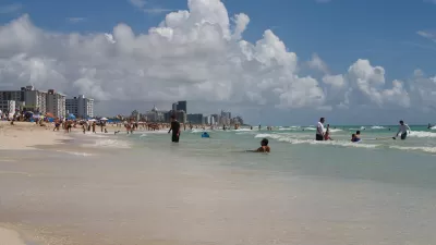
Miami Beach: A Four-Foot High Barrier Island Awaited Irma
A city of almost 92,000 people sits on a one-mile wide island designed by nature to protect the mainland from ocean swells, storms, and hurricanes. The seven-mile long island, which floods even when sunny, was spared from catastrophic storm surge.
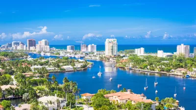
Hurricane Ian Puts Renewed Focus on Florida's Barrier Islands
Ian did not impact Southeast Florida, but coastal residents there took notice of the state's deadliest hurricane since 1935 that devastated much of Southwest Florida last month, particularly the barrier islands off the Gulf Coast.
As Development in Flood-Prone Areas Continues, Cities Are Slow to Respond
Drawn by affordable property, low taxes, and job opportunities, high numbers of Americans continue to move to flood-prone areas even as the threat of catastrophic flooding grows.

Alabama: Trump Terminates Settlements for Black Communities Harmed By Raw Sewage
Trump deemed the landmark civil rights agreement “illegal DEI and environmental justice policy.”

Planetizen Federal Action Tracker
A weekly monitor of how Trump’s orders and actions are impacting planners and planning in America.

The 120 Year Old Tiny Home Villages That Sheltered San Francisco’s Earthquake Refugees
More than a century ago, San Francisco mobilized to house thousands of residents displaced by the 1906 earthquake. Could their strategy offer a model for the present?

Study: How Urban Parks Can Support Biodiversity
Conservation and recreation can go hand in hand in urban green spaces designed to serve both humans and local wildlife.

High-Speed Rail Tracker
Smart Cities Dive follows high-speed rail developments around the country

Ken Jennings Launches Transit Web Series
The Jeopardy champ wants you to ride public transit.
Urban Design for Planners 1: Software Tools
This six-course series explores essential urban design concepts using open source software and equips planners with the tools they need to participate fully in the urban design process.
Planning for Universal Design
Learn the tools for implementing Universal Design in planning regulations.
Clanton & Associates, Inc.
Jessamine County Fiscal Court
Institute for Housing and Urban Development Studies (IHS)
City of Grandview
Harvard GSD Executive Education
Toledo-Lucas County Plan Commissions
Salt Lake City
NYU Wagner Graduate School of Public Service