


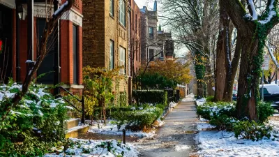
A side-by side-comparison of several cities’ snow routes reveals the inherent logic (or lack thereof) of their transportation infrastructure.
Emily Badger, inspired by a map of snow routes in Washington D.C., collected similar maps for a handful of cities around the country. Here’s what Badger found: “Compare these maps against each other, and they also reveal an underlying logic in how each city is organized, by grid (Chicago), by waterway (Philadelphia), or by relative chaos (we're looking at you, Louisville).”
The harsh nature of the current winter has provided plenty of perspective on transportation infrastructure. From sneckdowns to shutdowns—here's hoping communities are prepared to take the lessons of this winter and apply them to safer and more resilient infrastructures in the future.
FULL STORY: Cities, Mapped by Their Snow Routes

Chicago Budget Fails to Include Snow Plowing Program
Disability rights advocates say the “Plow the Sidewalks” program is a necessity for Chicagoans with limited mobility in winter months.
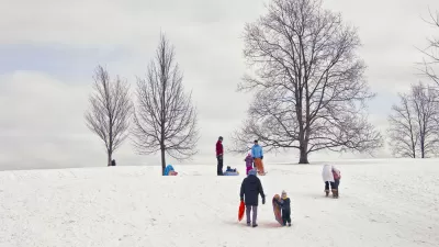
Winter Friday Fun: A Map of the Best Sledding Spots
There's a map of Boston that points out all the best sledding spots. It seems like there are millions of kids living in other parts around the country that could benefit from a sledding map of their hometown.
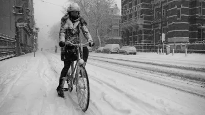
New Equipment and Staff for 'Non-Motorized Trail' Snow Removal Acquired in D.C.
A common wintertime compliant about snow removal for cars taking priority over bike lanes and sidewalks might be a little less common this winter.

Alabama: Trump Terminates Settlements for Black Communities Harmed By Raw Sewage
Trump deemed the landmark civil rights agreement “illegal DEI and environmental justice policy.”

Planetizen Federal Action Tracker
A weekly monitor of how Trump’s orders and actions are impacting planners and planning in America.

The 120 Year Old Tiny Home Villages That Sheltered San Francisco’s Earthquake Refugees
More than a century ago, San Francisco mobilized to house thousands of residents displaced by the 1906 earthquake. Could their strategy offer a model for the present?

Ken Jennings Launches Transit Web Series
The Jeopardy champ wants you to ride public transit.

BLM To Rescind Public Lands Rule
The change will downgrade conservation, once again putting federal land at risk for mining and other extractive uses.

Indy Neighborhood Group Builds Temporary Multi-Use Path
Community members, aided in part by funding from the city, repurposed a vehicle lane to create a protected bike and pedestrian path for the summer season.
Urban Design for Planners 1: Software Tools
This six-course series explores essential urban design concepts using open source software and equips planners with the tools they need to participate fully in the urban design process.
Planning for Universal Design
Learn the tools for implementing Universal Design in planning regulations.
Clanton & Associates, Inc.
Jessamine County Fiscal Court
Institute for Housing and Urban Development Studies (IHS)
City of Grandview
Harvard GSD Executive Education
Toledo-Lucas County Plan Commissions
Salt Lake City
NYU Wagner Graduate School of Public Service