


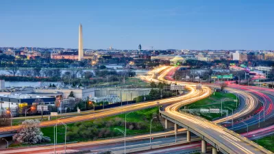
Adding 1,100 people every month, Washington D.C. is in the midst of one of the nation’s most powerful examples of population growth. A recently developed heat map shows where supply is being built to meet the new demand.
Pulling data from the District of Columbia Data Catalogue, blog Map Attacks has created a map showing every active building permit in the city, as of January 10, 2014. The visualization is useful in projecting the future of the nation's capital, which is drawing a large influx of new residents.
Dan Reed provides some local insight about the patterns visible on the map: “there's a lot of construction occurring in downtown DC, though there's also a significant amount of building taking place near U Street. H Street and Columbia Heights are no slouch, as well as Fort Totten, where a new Walmart is under construction.” Reed describes the orientation of construction permits by referencing some of the political dynamics at play in the development climate of the capital: “[the bulk of new construction occurring east of Rock Creek Park is] a good thing after decades of disinvestment, but it also illustrates how resistance to new development west of the park has pushed demand further east.”
One caveat about the heat map and its dataset from Map Attacks: “This dataset captures large construction projects like the O Street Market development in Shaw, as well as someone renovating their bathroom in Georgetown.”
FULL STORY: See where building construction is happening in DC

Transit-Oriented Development Central to D.C. Region's Growth Plan
Transit-oriented development will play a key role in mitigating the congestion effects of growing population in the region around the nation's capital, and regional planners say the region is already achieving its goals.
A Relentless D.C. Zoning Activist
Chris Otten says change doesn't come from "being nice to decision makers," so he's comfortable being confrontational with developers and City Council members he sees as taking advantage of the poor.

Explained: D.C. Gains '1,000 New Residents Every Month'
Officials and residents in Washington, D.C. are often heard saying that the District is gaining 1,000 new residents every month. But what does it mean?

Trump Administration Could Effectively End Housing Voucher Program
Federal officials are eyeing major cuts to the Section 8 program that helps millions of low-income households pay rent.

Planetizen Federal Action Tracker
A weekly monitor of how Trump’s orders and actions are impacting planners and planning in America.

Ken Jennings Launches Transit Web Series
The Jeopardy champ wants you to ride public transit.

Crime Continues to Drop on Philly, San Francisco Transit Systems
SEPTA and BART both saw significant declines in violent crime in the first quarter of 2025.

How South LA Green Spaces Power Community Health and Hope
Green spaces like South L.A. Wetlands Park are helping South Los Angeles residents promote healthy lifestyles, build community, and advocate for improvements that reflect local needs in historically underserved neighborhoods.

Sacramento Plans ‘Quick-Build’ Road Safety Projects
The city wants to accelerate small-scale safety improvements that use low-cost equipment to make an impact at dangerous intersections.
Urban Design for Planners 1: Software Tools
This six-course series explores essential urban design concepts using open source software and equips planners with the tools they need to participate fully in the urban design process.
Planning for Universal Design
Learn the tools for implementing Universal Design in planning regulations.
Heyer Gruel & Associates PA
Ada County Highway District
Institute for Housing and Urban Development Studies (IHS)
City of Grandview
Harvard GSD Executive Education
Toledo-Lucas County Plan Commissions
Salt Lake City
NYU Wagner Graduate School of Public Service