


While we won't live to see it, humanity's carbon emissions could one day melt all of the ice on Earth. National Geographic's interactive map shows how the world's coastlines would change when sea levels rise 216 feet. Say goodbye to Florida.
"The maps here show the world as it is now, with only one difference: All the ice on land has melted and drained into the sea, raising it 216 feet and creating new shorelines for our continents and inland seas."
"There are more than five million cubic miles of ice on Earth, and some scientists say it would take more than 5,000 years to melt it all. If we continue adding carbon to the atmosphere, we’ll very likely create an ice-free planet, with an average temperature of perhaps 80 degrees Fahrenheit instead of the current 58."
Scroll through the interactive map to see how rising seas will impact each continent. Africa is relatively unscathed, but "rising heat might make much of it uninhabitable". The Netherlands and Denmark will largely disappear, as will global capitals such as London, Buenos Aires, Singapore, and Shanghai.
FULL STORY: IF ALL THE ICE MELTED

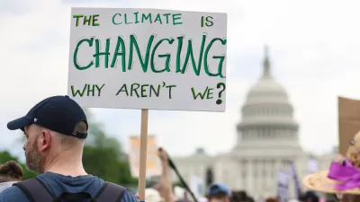
How Cities Can Curb Climate Change and Protect Vulnerable Residents
A new U.N. report urges cities to upgrade their infrastructure to bolster climate resilience and build more sustainable, climate-friendly places.

Bay Area Developments at Risk From Sea Level Rise
A controversial proposed housing development in Newark exemplifies the struggle between increasing housing supply and protecting vulnerable shoreline communities from flooding.
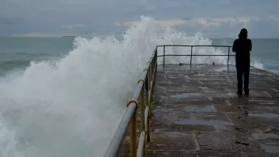
Visualizing the Effects of Sea Level Rise on U.S. Cities
A report from Climate Central calls for urgent action, illustrating the potential devastating impact of even a small rise in global temperature on the coastline of major cities.

Alabama: Trump Terminates Settlements for Black Communities Harmed By Raw Sewage
Trump deemed the landmark civil rights agreement “illegal DEI and environmental justice policy.”

Planetizen Federal Action Tracker
A weekly monitor of how Trump’s orders and actions are impacting planners and planning in America.

The 120 Year Old Tiny Home Villages That Sheltered San Francisco’s Earthquake Refugees
More than a century ago, San Francisco mobilized to house thousands of residents displaced by the 1906 earthquake. Could their strategy offer a model for the present?

Ken Jennings Launches Transit Web Series
The Jeopardy champ wants you to ride public transit.

BLM To Rescind Public Lands Rule
The change will downgrade conservation, once again putting federal land at risk for mining and other extractive uses.

Indy Neighborhood Group Builds Temporary Multi-Use Path
Community members, aided in part by funding from the city, repurposed a vehicle lane to create a protected bike and pedestrian path for the summer season.
Urban Design for Planners 1: Software Tools
This six-course series explores essential urban design concepts using open source software and equips planners with the tools they need to participate fully in the urban design process.
Planning for Universal Design
Learn the tools for implementing Universal Design in planning regulations.
Clanton & Associates, Inc.
Jessamine County Fiscal Court
Institute for Housing and Urban Development Studies (IHS)
City of Grandview
Harvard GSD Executive Education
Toledo-Lucas County Plan Commissions
Salt Lake City
NYU Wagner Graduate School of Public Service