


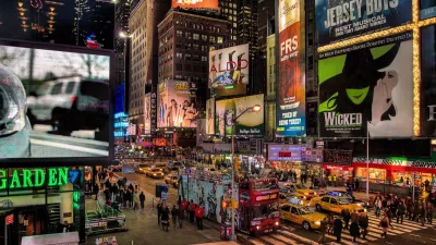
Utilizing an online tool that compares images from Google Street View, researchers have built a better understanding of the 'small, often imperceptible reasons' that make some streets and places feel safer than others.
In an effort to better understand perceptions of urban safety, researchers Phile Salesses, Katja Schechtner and César A. Hidalgo built an online tool that asks users to compare images from Boston, New York, and the Austrian cities of Salzburg and Linz. In a paper recently published in PLOS ONE, the authors discuss some of the patterns they've observed.
"We found images with trash in it, and took the trash out, and we noticed a 30 percent increase in perception of safety," Salesses says. "It's surprising that something that easy had that large an effect."
"This also means some fairly cost-effective government interventions – collecting trash – could have a significant impact on how safe people feel in a neighborhood," adds Emily Badger. "Ideally, in the future, [Salesses] envisions officials using a tool like this to do cost-benefit analyses of removing trash or planting new trees: Where should cities spend scarce resources to produce the greatest improvements in how people perceive a place?"
FULL STORY: The Small, Often Imperceptible Reasons Some Neighborhoods Feel Safer Than Others

Nightlife and the 15-Minute City
Plans for compact, walkable cities often don’t address nighttime concerns like transportation and lighting, which can make neighborhoods more vibrant and safe around the clock.
The Link Between Urban Design and Crime
A meta-study shows that public realm interventions can help reduce crime rates.

Parked Cars Hamper NYC Trash Containerization Effort
Sanitation workers must manually collect bags from containers blocked by parked cars, slowing a process that is meant to be safer and more efficient.

Trump Administration Could Effectively End Housing Voucher Program
Federal officials are eyeing major cuts to the Section 8 program that helps millions of low-income households pay rent.

Planetizen Federal Action Tracker
A weekly monitor of how Trump’s orders and actions are impacting planners and planning in America.

Ken Jennings Launches Transit Web Series
The Jeopardy champ wants you to ride public transit.

Washington Legislature Passes Rent Increase Cap
A bill that caps rent increases at 7 percent plus inflation is headed to the governor’s desk.

From Planning to Action: How LA County Is Rethinking Climate Resilience
Chief Sustainability Officer Rita Kampalath outlines the County’s shift from planning to implementation in its climate resilience efforts, emphasizing cross-departmental coordination, updated recovery strategies, and the need for flexible funding.

New Mexico Aging Department Commits to Helping Seniors Age ‘In Place’ and ‘Autonomously’ in New Draft Plan
As New Mexico’s population of seniors continues to grow, the state’s aging department is proposing expanded initiatives to help seniors maintain their autonomy while also supporting family caregivers.
Urban Design for Planners 1: Software Tools
This six-course series explores essential urban design concepts using open source software and equips planners with the tools they need to participate fully in the urban design process.
Planning for Universal Design
Learn the tools for implementing Universal Design in planning regulations.
Heyer Gruel & Associates PA
Ada County Highway District
Institute for Housing and Urban Development Studies (IHS)
City of Grandview
Harvard GSD Executive Education
Toledo-Lucas County Plan Commissions
Salt Lake City
NYU Wagner Graduate School of Public Service