


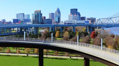
How much of a role does your city play in controlling its digital representation? Colin Wood examines the efforts of Louisville's director of innovation to link the city's assets digitally and integrate them with the prevailing platforms.
"In Louisville, Ky., Ted Smith, chief of economic growth and innovation, is working to help his fellow government agencies meet their goals by harnessing new approaches to open data in what he calls 'digital urban planning,'" reports Wood.
"Traditional city planning is just about the built environment -- things that are made of atoms and molecules," [Smith] said. "Digital urban planning is looking at your same city, but strictly in its digital representation and planning for its digital future.”
“What we don’t have right now is a formal discipline in government that says, ‘We have everything accurately portrayed in our built environment, in common digital tools,' Smith said, referencing such search tools as Google Maps, Apple Maps and MapQuest. Digital urban planning will begin with ensuring that government’s local assets – buildings, tourist attractions, public art, private businesses – appear in the tools most commonly used by the public. So if people are using Google Maps and Apple Maps, Smith said, then government should learn to use those tools too."
"Smith’s vision of digital urban planning in Louisville goes beyond maps -- eventually it could include every aspect of local life, connected online and linked to the real world," explains Wood. One example of what Smith has in mind is making data owned by the Kentucky Historical Society available to anyone at anytime by connecting it digitally to relevant places.
FULL STORY: Digital Urban Planning Starts with Common Tools

Louisville Creates its First Municipal DOT
The new department will be tasked with speeding up transportation and infrastructure projects.

Louisville Begins Process to Clean Superfund Site
A public forest is home to dozens of barrels that have been leaking toxic materials for decades.

Louisville High Injury Network To Help Guide Transportation Decisions
The new tool highlights the streets that pose the biggest risk to pedestrians and other road users.

Alabama: Trump Terminates Settlements for Black Communities Harmed By Raw Sewage
Trump deemed the landmark civil rights agreement “illegal DEI and environmental justice policy.”

Planetizen Federal Action Tracker
A weekly monitor of how Trump’s orders and actions are impacting planners and planning in America.

The 120 Year Old Tiny Home Villages That Sheltered San Francisco’s Earthquake Refugees
More than a century ago, San Francisco mobilized to house thousands of residents displaced by the 1906 earthquake. Could their strategy offer a model for the present?

Ken Jennings Launches Transit Web Series
The Jeopardy champ wants you to ride public transit.

BLM To Rescind Public Lands Rule
The change will downgrade conservation, once again putting federal land at risk for mining and other extractive uses.

Indy Neighborhood Group Builds Temporary Multi-Use Path
Community members, aided in part by funding from the city, repurposed a vehicle lane to create a protected bike and pedestrian path for the summer season.
Urban Design for Planners 1: Software Tools
This six-course series explores essential urban design concepts using open source software and equips planners with the tools they need to participate fully in the urban design process.
Planning for Universal Design
Learn the tools for implementing Universal Design in planning regulations.
Clanton & Associates, Inc.
Jessamine County Fiscal Court
Institute for Housing and Urban Development Studies (IHS)
City of Grandview
Harvard GSD Executive Education
Toledo-Lucas County Plan Commissions
Salt Lake City
NYU Wagner Graduate School of Public Service