


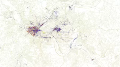
An announcement last week indicates that Wikipedia will become the newest player in the increasingly competitive effort to connect virtual information with physical places.
No, it doesn't sound like Wikipedia will be taking on Google Maps anytime soon, but last week "software engineer Max Semenik announced that the organization has created a GeoData extension that will include a centralized, structured catalog of geo-coordinates for articles," reports Henry Grabar. "More than 500,000 Wikipedia articles — approximately 5 percent of the site's content — already contain geographical information, but this new initiative will streamline data storage, enabling programmers to mine and map the data quickly and easily through the API."
So what does this mean for us? By more thoroughly geotagging the most popular encyclopedia on the Internet, a treasure trove of information will become available to programmers and entrepreneurs.
"The first appearance of the new GeoData extension is in a mobile add-on called 'Nearby,' which shows users a list of nearby Wikipedia entries. (To activate 'Nearby,' select 'Settings' from the drop-down menu on the Wikipedia Mobile site, then activate 'Beta' mode, save, and then activate 'Here Be Dragons' mode. 'Nearby' will appear in the drop-down menu.)"
"This software is a pretty simple beginning," says Grabar, "but it's easy to see how interesting it could get."
FULL STORY: Wikipedia Nearby Is Basically a List of Interesting Things Near You


Is it Time to Revive the Pattern Language?
Software and other fields have made brilliant progress with the pattern language methodology, while built environment fields lag badly, mired in parochial debates over the massive book that invented the methodology.
Friday Eye Candy: Maps Reveal Differences in How Locals and Tourists See the City
The cities that visitors see will always be different than the city that locals see. A new mapping project reveals the distinctions between the local perspective and the tourist perspective for 136 cities around the globe.

Mapping Interest in All Things Zombie
The three geographers behind the Floating Sheep blog have created a world map of Internet references to zombies.

Alabama: Trump Terminates Settlements for Black Communities Harmed By Raw Sewage
Trump deemed the landmark civil rights agreement “illegal DEI and environmental justice policy.”

Planetizen Federal Action Tracker
A weekly monitor of how Trump’s orders and actions are impacting planners and planning in America.

The 120 Year Old Tiny Home Villages That Sheltered San Francisco’s Earthquake Refugees
More than a century ago, San Francisco mobilized to house thousands of residents displaced by the 1906 earthquake. Could their strategy offer a model for the present?

USDOT Repeals Emissions Monitoring Rule
A Biden-era regulation required states to report and plan to reduce transportation-related emissions.

CaBi Breaks Ridership Record — Again
Washington D.C.’s bike share system is extremely popular with both residents and visitors.

San Francisco Opens Park on Former Great Highway
The Sunset Dunes park’s grand opening attracted both fans and detractors.
Urban Design for Planners 1: Software Tools
This six-course series explores essential urban design concepts using open source software and equips planners with the tools they need to participate fully in the urban design process.
Planning for Universal Design
Learn the tools for implementing Universal Design in planning regulations.
Clanton & Associates, Inc.
Jessamine County Fiscal Court
Institute for Housing and Urban Development Studies (IHS)
City of Grandview
Harvard GSD Executive Education
Toledo-Lucas County Plan Commissions
Salt Lake City
NYU Wagner Graduate School of Public Service