


I had heard of “dense sprawl” and “density without walkability” in the past, but before spending a week in Jerusalem last month, I had never really lived through these problems. My parents (who I was staying with) rented a unit in a high-rise condo complex called Holyland Tower. Although Holyland Tower was the tallest building in the area, there were numerous mid-rise buildings, and lots of two-and three-story apartment and condo buildings. While walking through the idea, I saw nothing resembling a single-family home. In sum, this area was a pretty dense neighborhood in a pretty dense city (Jerusalem’s overall density is roughly comparable to that of the city of San Francisco).

I had heard of "dense sprawl" and "density without
walkability" in the past, but before spending a week in Jerusalem last month, I had never really
lived through these problems.
My parents (who I was staying with) rented a unit in a
high-rise condo complex called Holyland
Tower. Although Holyland Tower
was the tallest building in the area, there were numerous mid-rise buildings,
and lots of two-and three-story apartment and condo buildings. While walking through the idea, I saw nothing
resembling a single-family home. In sum,
this area was a pretty dense neighborhood in a pretty dense city (Jerusalem's overall density is roughly comparable to that
of the city of San Francisco).
But although the density supported walking, the design did
not. To find the area, go to Google Maps
(maps.google.com) and go to a street called Avraham Perrera. You will note that the street is in a section
of looped streets that make the typical American cul-de-sac seem like a
masterpiece of clarity. As a result,
very little of interest is within walking distance, and what is within walking
distance is hard to find unless you know the area really, really, really well.
For example, the nearest restaurant is less than ¼ of a mile
away as the crow flies, but is about two miles away in reality. To get there, you have to go on five separate
streets. (To try it yourself, go to
Google Maps and ask for directions from Avraham Perrera to 5 Hose San Martin).
Because the succession of street loops is so confusing, even
places that are actually not very far are hard to find. For example, after I was in Jerusalem for a week I
discovered that there was in fact a small supermarket a ten or fifteen minute walk
away, but because of the messy street design (and admittedly, the rough terrain
as well) we were unaware of its existence.
By contrast, in a neighborhood with enough of a grid to distinguish
commercial from residential streets, commercial destinations are easy to
find. Admittedly, grids are more
difficult on hilly terrain such as that of Jerusalem.
But some American neighborhoods manage to combine walkability and hilly
terrain- for example, most of San Francisco, as
well as Philadelphia's
Manayunk.
So what my Jerusalem
neighborhood taught me was that with sufficiently poor street design, even a
fairly compact neighborhood may be more confusing to navigate, and separate
uses more aggressively, than some sprawling suburbs.


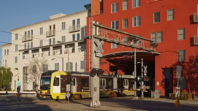
North Texas Transit Leaders Tout Benefits of TOD for Growing Region
At a summit focused on transit-oriented development, policymakers discussed how North Texas’ expanded light rail system can serve as a tool for economic growth.
California Bill Aims to Boost TOD
A bill proposed by Sen. Scott Wiener would exempt transit agencies from zoning rules near ‘high-quality’ transit stops and allow denser transit-oriented development.

Density and Disorder: The Imaginary Link
A recent article tries to tie public transit and walkability to social disorder — but in fact, sprawling Sunbelt cities like Memphis are as likely to have high crime rates as transit-rich metropolises such as New York and San Francisco.

Trump Administration Could Effectively End Housing Voucher Program
Federal officials are eyeing major cuts to the Section 8 program that helps millions of low-income households pay rent.

Planetizen Federal Action Tracker
A weekly monitor of how Trump’s orders and actions are impacting planners and planning in America.

Ken Jennings Launches Transit Web Series
The Jeopardy champ wants you to ride public transit.

USDOT Waters Down Self-Driving Car Regulations
The agency is reducing reporting requirements for autonomous vehicles and cars with self-driving features, prompting concern among safety advocates who say transparency is essential to the safe deployment of AV technology.

‘Minnesota Nice’ Isn’t so Nice When You Can’t Find a Place to Live
The Economic Development and Housing Challenge Program can help address the scourge of homelessness among Indigenous people.

NYC Open Streets Organizers Call for City Support
The number of open streets projects has dropped year after year as volunteer groups struggle to fund and staff them.
Urban Design for Planners 1: Software Tools
This six-course series explores essential urban design concepts using open source software and equips planners with the tools they need to participate fully in the urban design process.
Planning for Universal Design
Learn the tools for implementing Universal Design in planning regulations.
Heyer Gruel & Associates PA
Ada County Highway District
Institute for Housing and Urban Development Studies (IHS)
City of Grandview
Harvard GSD Executive Education
Toledo-Lucas County Plan Commissions
Salt Lake City
NYU Wagner Graduate School of Public Service