


As planners, one of our roles is to help stretch the scope of what is considered possible. For example, between 1950 and 2000 most development was highly automobile-dependent, based on the assumption that almost all travel would be by personal automobile and other modes were relatively unimportant. This pattern is so well established that many people have difficulty imagining anything different. It is useful to help people understand the full range of options available, from automobile dependency to carfree communities.

As planners, one of our roles is to help stretch the scope of what is considered possible. For example, between 1950 and 2000 most development was highly automobile-dependent, based on the assumption that almost all travel would be by personal automobile and other modes were relatively unimportant. This pattern is so well established that many people have difficulty imagining anything different. It is useful to help people understand the full range of options available, from automobile dependency to carfree communities.
Although carfree sounds radical, it was actually the goal of much suburban development, which was intended to create isolated suburban campuses where people can park their vehicles and walk through bucolic landscapes between buildings, and quiet cul de sacs where traffic impacts are minimized. This approach fails in many ways – the dispersed land use pattern that results creates more vehicle traffic with significant economic, social and environmental costs, but the basic desire for carfree environments is actually widely established. Most people would probably agree that carfree development is a nice idea, they simply have no idea how to achieve it.
A new book, Carfree Design Manual by J.H. Crawford, provides specific guidance for creating carfree communities. Crawford has long been a proponent of carfree planning: he wrote the book Carfree Cities in 2000, and maintains the Carfree.com website.

Crawford's book provides detailed discussion of carfree design concepts, that is, why carfree communities are desirable for economic, social and environmental reasons; their historic context; and the principles by which they can be implemented. His analysis begins with the most general concepts and works down to economic and engineering details, such as how to design communities (involve users), the best method to allocate land (use the Internet to allow households to bid for the properties that best reflect their preferences for location and building type), and to where to locate utility lines (bury them). Many of his ideas are insightful and well argued, although he may provide too much incidental detail for many readers.
Crawford draws extensively from previous urban designers, particularly Christopher Alexander, including A Pattern Language and the more recent series, The Nature of Order. He explores patterns related to building, street and neighborhood design.
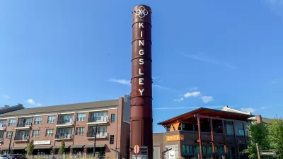
Crawford's ideal is based on medieval European cities, particularly Venice, Italian hilltowns, and other urban communities that developed prior to automobiles and elevators, and so have walkable boulevards radiating from plazas, four- to six-story buildings with housing above commercial constructed around central courtyards, and abundant civic amenities including neighborhood parks and local markets. To these he adds high quality rail transit systems, an efficient freight distribution system, and state-of-the-art underground utilities.
Crawford is a designer's designer, so every detail of the book is carefully considered and explained. It contains hundreds of illustrations and photos, many by Crawford himself, others based on his extensive collection of old postcards with photos of street scenes, urban skylines and buildings. These images are used to considerable advantage, described and discussed in the text to illustrate concepts and tell stories.
Planning practitioners should find plenty of inspiration in the book, but are likely to be frustrated by the lack of practical guidance for dealing with common planning problems. Crawford has strong opinions: he insists on totally car free cities with only grudging respect for New Urbanism or other incremental change. Much of his analysis assumes greenfield development: a parcel of land upon which a new neighborhood or entire city will be built, controlled by a central authority that has virtually unlimited control of urban design and management. There is little guidance for planners in existing communities who may want to support incremental change toward more multi-modal development. Such neighborhoods could be called "car light," but are usaully described as walkable communities or transit oriented development.
There is plenty of evidence that many people do want to drive less, rely more on walking, cycling and public transit, and live in more accessible, mixed-use communities, the sort of traditional neighborhoods people associate older small towns; unfortunately, just the sort of towns that often lost population and jobs due to centralization of employment and services. Ironically, the best current examples of these concepts in North America are artificial amusement parks, such as Disney World, which have very walkable streets, attractive (mostly) human scale buildings, convenient and attractive public transit, and underground utilities, but lack true community and diversity.
Despite these weaknesses I recommend the Carfree Design Manual, even for planning professionals not currently building car free cities, both as a stimulant for creative thinking and because it is a truly beautiful book.


Location Optimization Tools: Toward More Comprehensive and Multi-Modal Indicators
New tools are becoming available to help people evaluate the quality of walking, cycling, public transit and automobile accessibility when making home location decisions. This information can help create more efficient and sustainable communities.

The Natalist Case For Sprawl (And Why It Fails)
Some commentators defend anti-urban government policies such as exclusionary zoning on the basis that homeowning suburbanites have high birth rates. But this doesn't seem to be true in recent decades.
Rethinking Suburban Development: New Trends in Creating Livable Communities
Discover new trends in suburban development focused on creating more livable, sustainable communities for future growth.

Alabama: Trump Terminates Settlements for Black Communities Harmed By Raw Sewage
Trump deemed the landmark civil rights agreement “illegal DEI and environmental justice policy.”

Planetizen Federal Action Tracker
A weekly monitor of how Trump’s orders and actions are impacting planners and planning in America.

The 120 Year Old Tiny Home Villages That Sheltered San Francisco’s Earthquake Refugees
More than a century ago, San Francisco mobilized to house thousands of residents displaced by the 1906 earthquake. Could their strategy offer a model for the present?

Housing Vouchers as a Key Piece of Houston’s Housing Strategy
The Houston Housing Authority supports 19,000 households through the housing voucher program.

Rural Population Grew Again in 2024
Americans continued to move to smaller towns and cities, resulting in a fourth straight year of growth in rural areas.

Safe Streets Grants: What to Know
This year’s round of Safe Streets for All grant criteria come with some changes.
Urban Design for Planners 1: Software Tools
This six-course series explores essential urban design concepts using open source software and equips planners with the tools they need to participate fully in the urban design process.
Planning for Universal Design
Learn the tools for implementing Universal Design in planning regulations.
Clanton & Associates, Inc.
Jessamine County Fiscal Court
Institute for Housing and Urban Development Studies (IHS)
City of Grandview
Harvard GSD Executive Education
Toledo-Lucas County Plan Commissions
Salt Lake City
NYU Wagner Graduate School of Public Service