


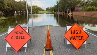
FEMA has redone official maps of flood-prone areas across the country, designating some as flood zones for the first time.
"The changes stem from the Federal Emergency Management Agency's multiyear plan to digitize its Flood Insurance Rate Maps to make them more accurate and easier to update.
New flood maps go into effect this month in 123 communities in Alabama, Georgia, Illinois, Kansas, Mississippi, North Carolina, South Carolina, Tennessee and Wisconsin. By 2010, about 92% of the population and 65% of the land in the USA will be covered by the maps, FEMA says.
The maps are the official record of the country's flood zones. The federal government requires properties in flood zones that have federally backed mortgages to carry flood insurance, FEMA spokesman Simon Chabel said. Mortgage companies also use the maps and can make flood insurance a condition for a loan."
FULL STORY: New high-tech FEMA maps redefine flood zones

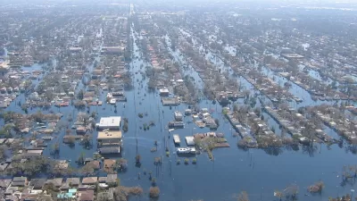
New Flood Maps Downplay Risks in New Orleans
Recently released flood maps created by FEMA for the city of New Orleans are receiving criticism for being 'overly optimistic' when it comes to risks posed by hurricanes and rising sea levels.

FEMA Resilience Program Cuts Grant Funding
The Building Resilient Infrastructure and Communities program funded projects from flood prevention to power station upgrades.
FEMA Suspends Flood Rebuilding Standard
The rule was designed to prevent the rebuilding of government-funded projects in areas prone to repeated floods.

Alabama: Trump Terminates Settlements for Black Communities Harmed By Raw Sewage
Trump deemed the landmark civil rights agreement “illegal DEI and environmental justice policy.”

Planetizen Federal Action Tracker
A weekly monitor of how Trump’s orders and actions are impacting planners and planning in America.

The 120 Year Old Tiny Home Villages That Sheltered San Francisco’s Earthquake Refugees
More than a century ago, San Francisco mobilized to house thousands of residents displaced by the 1906 earthquake. Could their strategy offer a model for the present?

In Both Crashes and Crime, Public Transportation is Far Safer than Driving
Contrary to popular assumptions, public transportation has far lower crash and crime rates than automobile travel. For safer communities, improve and encourage transit travel.

Report: Zoning Reforms Should Complement Nashville’s Ambitious Transit Plan
Without reform, restrictive zoning codes will limit the impact of the city’s planned transit expansion and could exclude some of the residents who depend on transit the most.

Judge Orders Release of Frozen IRA, IIJA Funding
The decision is a victory for environmental groups who charged that freezing funds for critical infrastructure and disaster response programs caused “real and irreparable harm” to communities.
Urban Design for Planners 1: Software Tools
This six-course series explores essential urban design concepts using open source software and equips planners with the tools they need to participate fully in the urban design process.
Planning for Universal Design
Learn the tools for implementing Universal Design in planning regulations.
Clanton & Associates, Inc.
Jessamine County Fiscal Court
Institute for Housing and Urban Development Studies (IHS)
City of Grandview
Harvard GSD Executive Education
Toledo-Lucas County Plan Commissions
Salt Lake City
NYU Wagner Graduate School of Public Service