


Recently released flood maps created by FEMA for the city of New Orleans are receiving criticism for being 'overly optimistic' when it comes to risks posed by hurricanes and rising sea levels.
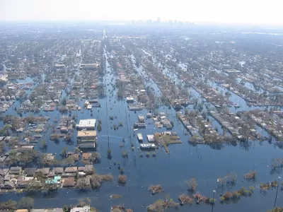
In an Op-Ed in The New York Times, Tulane University professor Andy Horowitz finds fault with the recently released flood maps for New Orleans that downplay risks in potentially vulnerable neighborhoods across the city. Horowitz writes that FEMA's original flood maps, drafted in 2009, were redrawn following complaints by New Orleans officials that they failed to take into account the new levee protections built after Hurricane Katrina. The new maps show no flood risks in many of the neighborhoods that flooded during Katrina, meaning homeowners in those neighborhoods no longer are required to buy flood insurance. Horowitz sees a potential catastrophe in the making.
[M]any of us will hold our breath through hurricane season nonetheless, because we know that the new maps reflect questionable assumptions. First, they assume that this time the Army Corps of Engineers’ work can be trusted, and the levee system will not fail again. ...a likely outcome of this new federal policy is that when — not if — New Orleans floods again, thousands of people will be worse off than they were during Hurricane Katrina: When their homes flood, they will not have flood insurance.
FULL STORY: New Orleans’s New Flood Maps: An Outline for Disaster

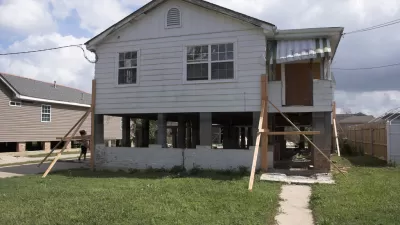
Louisiana Dials Back Requirements for Elevating Homes in Flood Areas
Housing market pressures, flood insurance costs, changing FEMA maps, and improved methods of flood control are giving victims of flood damage in Louisiana mixed signals on how high they should rebuild their homes.
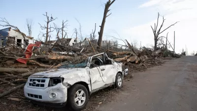
The Growing Role of Federal Government in Disaster Relief
As flooding, fires, and other disasters become more destructive, an effective response requires more resources than local governments can offer.
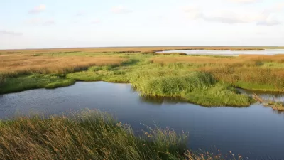
New Orleans Convent to Become Large Urban Wetland
Hurricane Katrina damaged a Catholic convent in New Orleans. Then the nuns spearheaded a project to transform the land into a wetland area that will protect the city from flooding in the future.

Study: Maui’s Plan to Convert Vacation Rentals to Long-Term Housing Could Cause Nearly $1 Billion Economic Loss
The plan would reduce visitor accommodation by 25,% resulting in 1,900 jobs lost.

Alabama: Trump Terminates Settlements for Black Communities Harmed By Raw Sewage
Trump deemed the landmark civil rights agreement “illegal DEI and environmental justice policy.”

Why Should We Subsidize Public Transportation?
Many public transit agencies face financial stress due to rising costs, declining fare revenue, and declining subsidies. Transit advocates must provide a strong business case for increasing public transit funding.

Paris Bike Boom Leads to Steep Drop in Air Pollution
The French city’s air quality has improved dramatically in the past 20 years, coinciding with a growth in cycling.

Why Housing Costs More to Build in California Than in Texas
Hard costs like labor and materials combined with ‘soft’ costs such as permitting make building in the San Francisco Bay Area almost three times as costly as in Texas cities.

San Diego County Sees a Rise in Urban Coyotes
San Diego County experiences a rise in urban coyotes, as sightings become prevalent throughout its urban neighbourhoods and surrounding areas.
Urban Design for Planners 1: Software Tools
This six-course series explores essential urban design concepts using open source software and equips planners with the tools they need to participate fully in the urban design process.
Planning for Universal Design
Learn the tools for implementing Universal Design in planning regulations.
Smith Gee Studio
Alamo Area Metropolitan Planning Organization
City of Santa Clarita
Institute for Housing and Urban Development Studies (IHS)
City of Grandview
Harvard GSD Executive Education
Toledo-Lucas County Plan Commissions
Salt Lake City
NYU Wagner Graduate School of Public Service