


Bernt Wahl is a pioneer of neighborhood mapping techniques. This profile in Wired profiles this growing industry, and Wahl's struggles with intellectual property. Who owns your neighborhood?
"Wahl began his work when he was contracted by real estate portal HomeGain to optimize the firm's search engine. At that time, real estate site maps were organized either by ZIP code or by census tract, which are both fairly arbitrary shapes drawn with disregard for the differences in the neighborhoods within. The Thomas Guides have long noted neighborhoods, but did not attempt to define where they begin and end.
Wahl saw that as a fatal flaw. "Neighborhoods are really important," he says. "For example, there's a census tract that combines downtown Berkeley and North Berkeley. In Berkeley hills, the average age is 57, and downtown it's 24. The incomes and values are completely different. It made me start thinking that we needed a different way to let people look for homes."
Working with 15 student interns, Wahl began phoning local-government planning departments, chambers of commerce and other community sources in hundreds of cities. "There's usually a librarian in each place who remembers the neighborhoods - the trick is finding them," Wahl says. "And you have to be careful about what people tell you, because they can tend to bleed their home into a better neighborhood."
Using the anecdotal data, Wahl drew polygons that contain the neighborhoods, then tacked them to base maps created by the U.S. Census. The new maps hit big. HomeGain went from limping into its last few million dollars of startup capital to being one of the leading real estate search sites."
FULL STORY: Lawsuit Claims Mapmaking Firm Owns Your Neighborhood


New Book Shows How Geographic Technology Tackles Global Challenges
In his new book, Jack Dangermond explores the transformative impact of GIS technology in solving global challenges through spatial data, highlighting its widespread application across sectors and its potential to design sustainable futures.

Building Healthier Communities: The Role of GIS in Park Planning
Integrating Geographic Information Systems (GIS) into park planning enhances community health by promoting physical activity, supporting mental well-being, fostering social connectedness, and addressing public health crises and climate change.
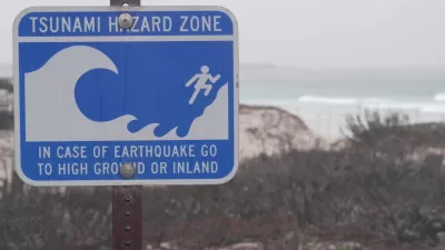
Washington State Requests Federal Funding for Tsunami Preparedness
The state’s Department of Natural Resources says it needs continued funding to map coastal areas at risk for tsunami impacts and prepare mitigation and evacuation plans.

Alabama: Trump Terminates Settlements for Black Communities Harmed By Raw Sewage
Trump deemed the landmark civil rights agreement “illegal DEI and environmental justice policy.”

Planetizen Federal Action Tracker
A weekly monitor of how Trump’s orders and actions are impacting planners and planning in America.

The 120 Year Old Tiny Home Villages That Sheltered San Francisco’s Earthquake Refugees
More than a century ago, San Francisco mobilized to house thousands of residents displaced by the 1906 earthquake. Could their strategy offer a model for the present?

Ken Jennings Launches Transit Web Series
The Jeopardy champ wants you to ride public transit.

BLM To Rescind Public Lands Rule
The change will downgrade conservation, once again putting federal land at risk for mining and other extractive uses.

Indy Neighborhood Group Builds Temporary Multi-Use Path
Community members, aided in part by funding from the city, repurposed a vehicle lane to create a protected bike and pedestrian path for the summer season.
Urban Design for Planners 1: Software Tools
This six-course series explores essential urban design concepts using open source software and equips planners with the tools they need to participate fully in the urban design process.
Planning for Universal Design
Learn the tools for implementing Universal Design in planning regulations.
Clanton & Associates, Inc.
Jessamine County Fiscal Court
Institute for Housing and Urban Development Studies (IHS)
City of Grandview
Harvard GSD Executive Education
Toledo-Lucas County Plan Commissions
Salt Lake City
NYU Wagner Graduate School of Public Service