


The use of geographic information systems for the public good is a rapidly growing field. The technology shows great promise for discovering unequal distribution of resources and environmental racism, writes Peter Manzo.
"As Buckaroo Banzai and Buddhist sages put it, 'wherever you go, there you are.' But for too many people around the world, the inverse is true-wherever you are determines where you can go. Place matters to our quality of life far more than whether we can find good coffee or a particular kind of food or entertainment. Our prospects for enjoying clean air and water, healthy food, freedom from violence, and opportunities to learn may be tied more closely to where we live than any other characteristic. Place is where the intersection of race, class, and power is shown in starkest relief."
"...Advocates, planners and funders are increasingly using GIS mapping to analyze a host of issues. Civil rights lawyers, environmental justice activists, and community organizers are using maps to anchor dialogue with community members, adding their on-the-ground knowledge to "official" data, and also to make their case to policy makers and judges."
FULL STORY: Maps for Driving Change

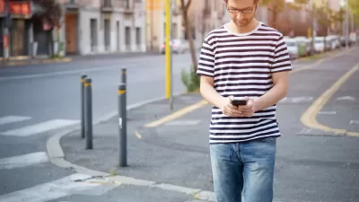
An iPhone in the City
What's better than Twitter in the city? An iPhone. With a connection to the Internet, built-in camera, location-awareness, 3-access accelerometer and colorful display, the Apple iPhone has become much more than a mobile phone: it's a sophisticated mobile computing platform. Combine this technology with a library of thousands of programs and growing ecosystem of developers, the iPhone is powerful and versatile tool to transform how people interact with their surroundings. A growing number of iPhone apps are taking advantage of the phone's functionality to allow people to navigate, measure, observe, and interact with cities in new ways. This post describes some I have come across for e-government, urban sensing and interaction, and navigation. First, a caveat: I don't actually own one of the devices myself and haven't tested the apps (yet). I've certainly missed many, so leave your favorites in the comments below.
Location Data Could Unlock a Less Car-Centric Future
A report from the Brookings Institution shows how planners can use new types of anonymized data to inform mobility planning decisions.
A Public Transit App for Knoxville, Tennessee
Years after other cities implemented transit trackers, Knoxville is getting a bus tracker to help commuters move through the city.

Alabama: Trump Terminates Settlements for Black Communities Harmed By Raw Sewage
Trump deemed the landmark civil rights agreement “illegal DEI and environmental justice policy.”

Planetizen Federal Action Tracker
A weekly monitor of how Trump’s orders and actions are impacting planners and planning in America.

The 120 Year Old Tiny Home Villages That Sheltered San Francisco’s Earthquake Refugees
More than a century ago, San Francisco mobilized to house thousands of residents displaced by the 1906 earthquake. Could their strategy offer a model for the present?

Ken Jennings Launches Transit Web Series
The Jeopardy champ wants you to ride public transit.

BLM To Rescind Public Lands Rule
The change will downgrade conservation, once again putting federal land at risk for mining and other extractive uses.

Indy Neighborhood Group Builds Temporary Multi-Use Path
Community members, aided in part by funding from the city, repurposed a vehicle lane to create a protected bike and pedestrian path for the summer season.
Urban Design for Planners 1: Software Tools
This six-course series explores essential urban design concepts using open source software and equips planners with the tools they need to participate fully in the urban design process.
Planning for Universal Design
Learn the tools for implementing Universal Design in planning regulations.
Clanton & Associates, Inc.
Jessamine County Fiscal Court
Institute for Housing and Urban Development Studies (IHS)
City of Grandview
Harvard GSD Executive Education
Toledo-Lucas County Plan Commissions
Salt Lake City
NYU Wagner Graduate School of Public Service