


A new interactive mapping website launched by the Center for Neighborhood Technology in partnership with The Brookings Institution shows how affordability changes from neighborhood to neighborhood based on housing and transportation.
"When you're stuck in Beltway traffic burning $3-a-gallon gasoline to creep along at walking speed, it offers time to think. Would it be easier if I left home earlier? Would I be better off riding a train? How bad will my commute be in five years? Would life be easier and cheaper if I found a job in Pittsburgh or Nashville or some other place where the roads aren't as crowded and the homes aren't so expensive?
A new Web-based tool developed by the Center for Neighborhood Technology, a Chicago-based urban development think tank, can help put facts behind those daydreams. The CNT developed a Web site, at http://htaindex.cnt.org, that takes into account household expenditures for transportation, along with home prices, to estimate whether a home is truly affordable for households with moderate incomes.
Academics at the CNT argue that a home isn't really affordable if its location forces a household to devote an excessive amount of the family budget to transportation. How much is excessive? They say 18 percent of the area's median pretax income is typical; lowering that to 15 percent would be better. That's on top of the 30 percent of pretax income that they estimate as an affordable budget for a home's mortgage principal and interest plus property taxes and homeowners' insurance, which lenders call PITI.
With gasoline prices nearing $3.50 per gallon and Metro fares that recently increased by the largest amount in the transit system's history, keeping Washington-area transportation costs below those thresholds is only going to become more difficult.
The Web site is a data fest even by wonk standards. It's a map-based tool offering information on housing and transportation costs for 52 metropolitan areas, including the Washington-Baltimore area. You can zoom in on individual neighborhoods and pull up U.S. Census information on the percentage of neighborhood residents who use mass transit, their average monthly spending on transportation, the number of wage-earners and cars per household, and other data. The Web site also displays nearby subway and commuter rail lines and stations."
Thanks to Nicole Gotthelf
FULL STORY: Mapping Transportation Costs for Home Buyers


Where Will Gentrification Happen Next?
This map tool hows gentrification-related statistics by Bay Area neighborhood, helping communities guess where the heaviest gentrification will occur.
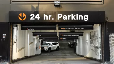
Comprehensive Parking Supply, Cost, and Price Analysis
Every time somebody purchases a vehicle they expect governments and businesses to provide parking for their use. These facilities are costly. For every dollar motorists spend on their vehicles somebody spends about a dollar on parking.

New Book Shows How Geographic Technology Tackles Global Challenges
In his new book, Jack Dangermond explores the transformative impact of GIS technology in solving global challenges through spatial data, highlighting its widespread application across sectors and its potential to design sustainable futures.

Trump Administration Could Effectively End Housing Voucher Program
Federal officials are eyeing major cuts to the Section 8 program that helps millions of low-income households pay rent.

Planetizen Federal Action Tracker
A weekly monitor of how Trump’s orders and actions are impacting planners and planning in America.

Ken Jennings Launches Transit Web Series
The Jeopardy champ wants you to ride public transit.

Crime Continues to Drop on Philly, San Francisco Transit Systems
SEPTA and BART both saw significant declines in violent crime in the first quarter of 2025.

How South LA Green Spaces Power Community Health and Hope
Green spaces like South L.A. Wetlands Park are helping South Los Angeles residents promote healthy lifestyles, build community, and advocate for improvements that reflect local needs in historically underserved neighborhoods.

Sacramento Plans ‘Quick-Build’ Road Safety Projects
The city wants to accelerate small-scale safety improvements that use low-cost equipment to make an impact at dangerous intersections.
Urban Design for Planners 1: Software Tools
This six-course series explores essential urban design concepts using open source software and equips planners with the tools they need to participate fully in the urban design process.
Planning for Universal Design
Learn the tools for implementing Universal Design in planning regulations.
Heyer Gruel & Associates PA
Ada County Highway District
Institute for Housing and Urban Development Studies (IHS)
City of Grandview
Harvard GSD Executive Education
Toledo-Lucas County Plan Commissions
Salt Lake City
NYU Wagner Graduate School of Public Service