


Ubiquitous access to GPS data and social software is generating a whole new breed of cartographers who are empowering themselves and others by mapping everything from community assets to occurrence of disease.
"Maps are everywhere these days. The ubiquity of global positioning systems (GPS) and mobile directional devices, interactive mapping tools and social networks is feeding a mapping boom. Amateur geographers are assigning coordinates to everything they can get their hands on-and many things they can't. "Locative artists" are attaching virtual installations to specific locales, generating imaginary landscapes brought vividly to life in William Gibson's latest novel, Spook Country. Indeed, proponents of "augmented reality" suggest that soon our current reality will be one of many "layers" of information available to us as we stroll down the street.
Multimedia designer Sha Sha Feng recently completed a Master of Fine Arts project at Hunter College in New York titled "MapaboutMaps," using Google Earth as a platform to host video interviews about new directions in mapping with geographers, artists and programmers.
Feng was particularly interested in examining the role maps can play in building community. She interviewed Wendy Brawer, the founder of Greenmap Systems, a website that engages local mapping teams to chart their communities' natural and green living landmarks, including farmers markets, organic food producers, fair trade shops, indigenous sites and the best spots for star-gazing. "Maps are very personal objects," says Brawer. "People look for themselves on them."
Participatory mapping tools have "opened the world of maps from a few to many," says Feng. "Maps are powerful tools. Many people take them as fact, but they tell the story that the creator wants you to see. Grassroots communities and artists welcome this technology because it allows their voices to be heard."
In many ways, these mapping tools are re-locating us as the center of our personal universes. We no longer go to maps to find out where we are. Instead, we tell maps where we are and they form around us on the fly, a sensation that can be comforting or stifling. After all, while finding the right map can orient you, having dozens can threaten to tip the signal-to-noise ratio toward cacophony.
On balance, though, the democratization of mapping and visualization tools generates possibilities for self-expression and social action. Two decades ago, postmodern theorist Frederic Jameson argued that developing new maps would be central for activists hoping to grapple with the emerging global business and communication systems. "[The] incapacity to map socially is as crippling to political experience as the analogous incapacity to map spatially is for urban experience," he wrote.
The tools are now available. The question now: Where do we go from here?"
FULL STORY: The New Cartographers


New Book Shows How Geographic Technology Tackles Global Challenges
In his new book, Jack Dangermond explores the transformative impact of GIS technology in solving global challenges through spatial data, highlighting its widespread application across sectors and its potential to design sustainable futures.

Building Healthier Communities: The Role of GIS in Park Planning
Integrating Geographic Information Systems (GIS) into park planning enhances community health by promoting physical activity, supporting mental well-being, fostering social connectedness, and addressing public health crises and climate change.
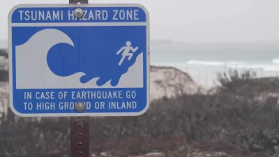
Washington State Requests Federal Funding for Tsunami Preparedness
The state’s Department of Natural Resources says it needs continued funding to map coastal areas at risk for tsunami impacts and prepare mitigation and evacuation plans.

Trump Administration Could Effectively End Housing Voucher Program
Federal officials are eyeing major cuts to the Section 8 program that helps millions of low-income households pay rent.

Planetizen Federal Action Tracker
A weekly monitor of how Trump’s orders and actions are impacting planners and planning in America.

Ken Jennings Launches Transit Web Series
The Jeopardy champ wants you to ride public transit.

Crime Continues to Drop on Philly, San Francisco Transit Systems
SEPTA and BART both saw significant declines in violent crime in the first quarter of 2025.

How South LA Green Spaces Power Community Health and Hope
Green spaces like South L.A. Wetlands Park are helping South Los Angeles residents promote healthy lifestyles, build community, and advocate for improvements that reflect local needs in historically underserved neighborhoods.

Sacramento Plans ‘Quick-Build’ Road Safety Projects
The city wants to accelerate small-scale safety improvements that use low-cost equipment to make an impact at dangerous intersections.
Urban Design for Planners 1: Software Tools
This six-course series explores essential urban design concepts using open source software and equips planners with the tools they need to participate fully in the urban design process.
Planning for Universal Design
Learn the tools for implementing Universal Design in planning regulations.
Heyer Gruel & Associates PA
Ada County Highway District
Institute for Housing and Urban Development Studies (IHS)
City of Grandview
Harvard GSD Executive Education
Toledo-Lucas County Plan Commissions
Salt Lake City
NYU Wagner Graduate School of Public Service