


The Strange Maps blog is an eclectic collection of maps, diagrams, and cartoons. Some graphics featured on this blog are informative, some are creative, and others are completely bizarre.The website is maintained by an anonymous blogger. The posted graphic is often accompanied by informative notes. Here is a list of 21 maps that I found interesting:

 The Strange Maps blog is an eclectic collection of maps, diagrams, and cartoons. Some graphics featured on this blog are informative, some are creative, and others are completely bizarre.The website is maintained by an anonymous blogger. The posted graphic is often accompanied by informative notes. Here is a list of 21 maps that I found interesting:
Transit Map of the World's Transit Systems
Cities with urban rail systems.
Driving Orientation: A World Map
The origins of traffic driving on the right or left side of the road.
A Diagram of the Eisenhower Interstate System
Which interstates do not cross state lines?
"Slumless, Smokeless Cities"
How geometric can urban planning get?
A Texan's Map of the United States
Don't mess with this map.
The World As Seen From New York's 9th Avenue
A New York state of mind.
GDP Map of the USA
U.S. states labelled as countries with similar GDP.
The Nine Nations of North America
Regions with similar cultural and economic features.
The United Countries of Baseball
You can observe a lot by watching this map.
Shifting Like A Snake: Ancient Mississippi Courses
Nature the artist.
The Patients Per Doctor Map of the World
More effective than presenting data in a table.
World-Wide Web Map, From .ad to .za
What does Los Angeles have in common with Laos?
A Map of the Internet's Black Holes
Countries where internet use is censored or limited.
Online Communities Map (Not For Navigation)
Where do you live on this map?
A Subway Map of Web Trends 2.0
When are they going to release Web 3.0?
UFO Hotspots Map
See where extraterrestrials like to hang out.
The Most Generic Country Ever
A quick geography lesson.
Oh, Inverted World
What if all the land was water?
Where On Earth Was Middle-earth?
One map to rule them all.
Found: a Map of the Island in ‘Lost'
But can it help you make sense of the storyline?
A Simplified Map of London
The simplest map in the collection.
If you have any interesting graphics to share please send it to Strange Maps and help add to this fascinating collection.


New Book Shows How Geographic Technology Tackles Global Challenges
In his new book, Jack Dangermond explores the transformative impact of GIS technology in solving global challenges through spatial data, highlighting its widespread application across sectors and its potential to design sustainable futures.

Building Healthier Communities: The Role of GIS in Park Planning
Integrating Geographic Information Systems (GIS) into park planning enhances community health by promoting physical activity, supporting mental well-being, fostering social connectedness, and addressing public health crises and climate change.
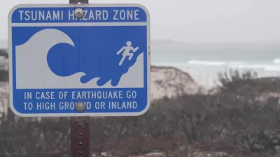
Washington State Requests Federal Funding for Tsunami Preparedness
The state’s Department of Natural Resources says it needs continued funding to map coastal areas at risk for tsunami impacts and prepare mitigation and evacuation plans.

Alabama: Trump Terminates Settlements for Black Communities Harmed By Raw Sewage
Trump deemed the landmark civil rights agreement “illegal DEI and environmental justice policy.”

Planetizen Federal Action Tracker
A weekly monitor of how Trump’s orders and actions are impacting planners and planning in America.

The 120 Year Old Tiny Home Villages That Sheltered San Francisco’s Earthquake Refugees
More than a century ago, San Francisco mobilized to house thousands of residents displaced by the 1906 earthquake. Could their strategy offer a model for the present?

Ken Jennings Launches Transit Web Series
The Jeopardy champ wants you to ride public transit.

BLM To Rescind Public Lands Rule
The change will downgrade conservation, once again putting federal land at risk for mining and other extractive uses.

Indy Neighborhood Group Builds Temporary Multi-Use Path
Community members, aided in part by funding from the city, repurposed a vehicle lane to create a protected bike and pedestrian path for the summer season.
Urban Design for Planners 1: Software Tools
This six-course series explores essential urban design concepts using open source software and equips planners with the tools they need to participate fully in the urban design process.
Planning for Universal Design
Learn the tools for implementing Universal Design in planning regulations.
Clanton & Associates, Inc.
Jessamine County Fiscal Court
Institute for Housing and Urban Development Studies (IHS)
City of Grandview
Harvard GSD Executive Education
Toledo-Lucas County Plan Commissions
Salt Lake City
NYU Wagner Graduate School of Public Service