


Miami is denser than most American cities, but is more car-dependent than some less compact cities. Why?


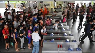
Last weekend, I went to Miami for a conference, and explored a wide range of neighborhoods, including both suburbs like Sweetwater and North Miami, and urban places such as Wynwood and downtown Miami. One of the most unusual things about Miami is that it combines a high density (over 12,000 people per mile in its small central city) with relatively low transit ridership (about 7 percent in 2022, lower than medium-density cities like Buffalo).* Even some of its suburbs are pretty dense: North Miami Beach (where I stayed over the weekend) has just over 8500 residents per square mile, and Sweetwater (where I stayed Sunday night) is more densely populated than Miami. What is Miami doing wrong?
The first thing I noticed was that except for the quietest residential streets, commercial streets are designed for high-speed traffic — even in parts of a city where walking would normally be common. For example, Brickell Avenue is one of downtown’s more high-end streets, one with a significant amount of housing and public transit. So you might think that Brickell is a comfortable street for pedestrians. But Brickell is six lanes wide, not my idea of a pedestrian-friendly layout. Similarly, you might think that streets near Florida International University (FIU) would be pretty walkable — but FIU is moated off from Sweetwater (a suburb just to its north) by an eight-lane street that resembles a highway with traffic lights more than it resembles a commercial street. To make matters worse, this highway is not even fully connected to the Sweetwater street grid: instead of crossing every block to get to FIU, a walker can only cross the street once every several blocks.
Of course, these are major streets. But Miami also suffers from what traffic engineers call collector streets: streets that lack the commerce and excitement of high-traffic arterials but are nevertheless just wide enough to have dangerously fast car traffic. For example, in North Miami Beach, I mostly walked on N.E. 179th Street and the streets just to its north from Northeast 13th Avenue to Northeast 18th Avenue. 13th and 14th Avenues are quiet, two-lane residential streets that I felt comfortable crossing. By contrast, 15th Avenue has a turning lane and is just wide enough to support faster traffic. As a result, crossing it was a bit adventurous.
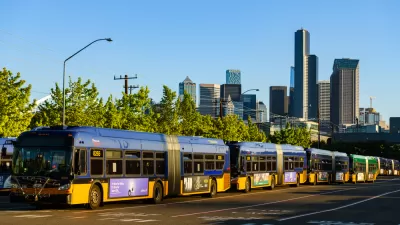
On the positive side, most of the city buses I was on were at least half full, and some were standing room only. However, bus rides from city to suburb can be quite long: for example, my ride from downtown Miami to North Miami Beach took almost two hours. By contrast, in Buffalo, most bus routes take only an hour from beginning to end, and even the 20-mile bus ride from Buffalo to Niagara Falls takes about 75 minutes.
This example illustrates a broader problem with city buses in large metro areas: in an area as large as Los Angeles or Miami-Dade County, suburbs can be so far away from a city that bus commutes can take longer than in a smaller but less dense metro. It follows that in a largish metro area, even an otherwise adequate bus network and high central-city density doesn’t protect people from long commutes. And Miami does not have a strong rail system to supplement its buses: Miami’s Metro Rail has only one line, fewer than other Sun Belt metros such as Atlanta (two lines) or Dallas (five). In other words, you can get almost anywhere in Miami Dade County by bus, but it may take a long time to do so.
On the positive side, Miami suburbs are a little more generous with housing than the suburbs of Blue America. On the major Long Island arterials I have seen, housing other than single-family homes is rare. By contrast, the major arterial I saw in North Miami Beach (Northeast 185th Street) did have plenty of apartments, even though the nearby homeowner blocks had none. So at least Miami’s suburbs have done something to alleviate the national housing famine. Sweetwater was even more generous; I saw apartments on side streets as well as on Flagler (the city’s major arterial).
In sum, Miami underperforms when it comes to transit, with a lower transit mode share than some lower-density cities. Although I am not completely sure why this is the case, one possible reason is that streets are designed for speeding cars to an even greater extent than in other American cities. In addition, Miami is just large enough that city-to-suburb bus commutes can be more punishing than in a smaller metro like Buffalo.
*Pre-COVID data is similar: in 2015, 11 percent of Miami commutes were by transit, well below the mode share for medium-density Rust Belt cities like Baltimore, Pittsburgh and Hartford. I note, however, that Miami's transit ridership was higher than that of Sun Belt cities like Atlanta and Dallas.

!["I [heart] Philadelphia" sign in front of fountain with city hall building in background](/files/styles/small_400/public/images/AdobeStock_514479381_Editorial_Use_Only.jpeg.webp?itok=3o9OsQs9)
Philadelphia’s City Center Rates Highly for Transit, Walkability
While not all parts of the city are equally accessible, its central district boasts one of the nation’s densest transit networks and high ridership rates.
Strategies for Maximizing Transit Ridership
Jarrett Walker outlines the conditions under which transit serves the greatest number of travelers. Maximizing ridership, he argues, requires thinking like a business and catering to demand.
Seattle to Reinstate Bus Fare Enforcement
After a COVID-era move to eliminate fare inspections on city buses, King County Metro is reinstating checks for fare evasion.

What ‘The Brutalist’ Teaches Us About Modern Cities
How architecture and urban landscapes reflect the trauma and dysfunction of the post-war experience.

‘Complete Streets’ Webpage Deleted in Federal Purge
Basic resources and information on building bike lanes and sidewalks, formerly housed on the government’s Complete Streets website, are now gone.

Montreal’s Gorilla Park Repurposes Defunct Railway Track
The park is part of a global movement to build public spaces that connect neighbors and work with local elements to serve as key parts of a city’s green infrastructure.

Art in Action: USC Event Calls for an Urgent Green Energy Transition
The El Respiro / Respire event at USC uses a large-scale human geochoreography to demand an urgent and equitable transition to green energy, blending art, activism, and community engagement to amplify the message of climate justice.

Safe Parking Programs Help People Access Housing
The safety and stability offered by Safe Parking sites have helped 40 percent of unhoused San Diego residents who accessed these programs get into permanent housing.

Study: Single-Staircase Buildings Pose No Additional Risks
Zoning codes have long prohibited single-stair residential buildings due to safety concerns, but changing that could lower the cost of construction and allow for more flexible housing designs.
Urban Design for Planners 1: Software Tools
This six-course series explores essential urban design concepts using open source software and equips planners with the tools they need to participate fully in the urban design process.
Planning for Universal Design
Learn the tools for implementing Universal Design in planning regulations.
North Jersey Transportation Planning Authority (NJTPA)
Economic & Planning Systems, Inc.
UCLA Lewis Center for Regional Policy Studies
Mpact (formerly Rail~Volution)
Chaddick Institute at DePaul University
City of Piedmont, CA
Great Falls Development Authority, Inc.
HUDs Office of Policy Development and Research