


A new tool could help the city reach its goal of planting up to 250,000 new trees by 2035.
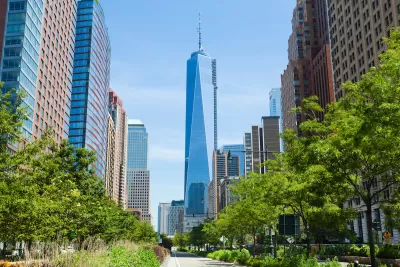
Writing in Yahoo News, Willy Appelman describes how New York City is using data collection and advanced technology to monitor its tree canopy and assess when and where new trees should be planted to supplement the city’s urban forest.
A project called Tree Folio NYC uses lidar data to “measure the size and volume of individual canopies, making it easier to see where healthy trees are located and where existing canopies are lacking,” according to Cornell University researcher Alexander Kobald.
The tool could help the city keep a closer eye on its trees, which have a lifespan almost ten times as short as a similar tree in a rural environment due to exposure to pollutants like dog urine and salt from street treatments.
Appelman notes that “New York City recently passed measures aiming for 30% tree canopy cover by 2035, intending to plant up to 250,000 new trees.”
FULL STORY: Researchers advocate for new tech to revolutionize NYC infrastructure, and it’s likely not what you think

Invasive Beetles Put Oregon Forests at Risk
Two recently discovered borer beetles could lead to a significant loss of tree canopy.

Urban Trees Have Bigger Impact in Hot, Dry Cities
The cooling effect of robust urban tree canopies is more pronounced in hotter, drier cities like Phoenix and Las Vegas.
The Economic Value of Street Trees
Far from just providing shade and improving air quality, trees can also contribute to more resilient roads, lower energy costs, and reduced flood risk.

Alabama: Trump Terminates Settlements for Black Communities Harmed By Raw Sewage
Trump deemed the landmark civil rights agreement “illegal DEI and environmental justice policy.”

Planetizen Federal Action Tracker
A weekly monitor of how Trump’s orders and actions are impacting planners and planning in America.

The 120 Year Old Tiny Home Villages That Sheltered San Francisco’s Earthquake Refugees
More than a century ago, San Francisco mobilized to house thousands of residents displaced by the 1906 earthquake. Could their strategy offer a model for the present?

Ken Jennings Launches Transit Web Series
The Jeopardy champ wants you to ride public transit.

BLM To Rescind Public Lands Rule
The change will downgrade conservation, once again putting federal land at risk for mining and other extractive uses.

Indy Neighborhood Group Builds Temporary Multi-Use Path
Community members, aided in part by funding from the city, repurposed a vehicle lane to create a protected bike and pedestrian path for the summer season.
Urban Design for Planners 1: Software Tools
This six-course series explores essential urban design concepts using open source software and equips planners with the tools they need to participate fully in the urban design process.
Planning for Universal Design
Learn the tools for implementing Universal Design in planning regulations.
Clanton & Associates, Inc.
Jessamine County Fiscal Court
Institute for Housing and Urban Development Studies (IHS)
City of Grandview
Harvard GSD Executive Education
Toledo-Lucas County Plan Commissions
Salt Lake City
NYU Wagner Graduate School of Public Service