


The GIS tool is designed to help developers find vacant and blighted lots that could be restored for new housing or other uses.
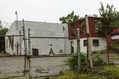
A new GIS tool will help developers in DeKalb County identify “blighted or underused sites” in the region, as well as financial incentives to help move redevelopment projects forward.
According to an article by Josh Green in Urbanize Atlanta, “The layered GIS map is designed to bring brownfield sites to light in a digestible, one-stop-shop way, with pertinent details such as ownership and type of potential hazard listed for hundreds of properties.” The map includes the city of Atlanta.
Although brownfield are defined as sites impacted by environmental contamination, “not all sites on DeKalb’s GIS page need remediation, per the mapping tool.” Local economic development authority Decide DeKalb, who collaborated with the county on the tool, plans to help developers find potential funding sources for site cleanup efforts.
FULL STORY: New tool helps investors find janky development sites across DeKalb


Revitalizing Cities Through Soil Health, Green Spaces, and Nature-Based Remediation
Investing in soil health, urban parks, and nature-based solutions for brownfield remediation is essential for creating resilient cities, restoring ecosystems, and improving community well-being.

New Book Shows How Geographic Technology Tackles Global Challenges
In his new book, Jack Dangermond explores the transformative impact of GIS technology in solving global challenges through spatial data, highlighting its widespread application across sectors and its potential to design sustainable futures.

Building Healthier Communities: The Role of GIS in Park Planning
Integrating Geographic Information Systems (GIS) into park planning enhances community health by promoting physical activity, supporting mental well-being, fostering social connectedness, and addressing public health crises and climate change.

Alabama: Trump Terminates Settlements for Black Communities Harmed By Raw Sewage
Trump deemed the landmark civil rights agreement “illegal DEI and environmental justice policy.”

Planetizen Federal Action Tracker
A weekly monitor of how Trump’s orders and actions are impacting planners and planning in America.

The 120 Year Old Tiny Home Villages That Sheltered San Francisco’s Earthquake Refugees
More than a century ago, San Francisco mobilized to house thousands of residents displaced by the 1906 earthquake. Could their strategy offer a model for the present?

In Both Crashes and Crime, Public Transportation is Far Safer than Driving
Contrary to popular assumptions, public transportation has far lower crash and crime rates than automobile travel. For safer communities, improve and encourage transit travel.

Report: Zoning Reforms Should Complement Nashville’s Ambitious Transit Plan
Without reform, restrictive zoning codes will limit the impact of the city’s planned transit expansion and could exclude some of the residents who depend on transit the most.

Judge Orders Release of Frozen IRA, IIJA Funding
The decision is a victory for environmental groups who charged that freezing funds for critical infrastructure and disaster response programs caused “real and irreparable harm” to communities.
Urban Design for Planners 1: Software Tools
This six-course series explores essential urban design concepts using open source software and equips planners with the tools they need to participate fully in the urban design process.
Planning for Universal Design
Learn the tools for implementing Universal Design in planning regulations.
Clanton & Associates, Inc.
Jessamine County Fiscal Court
Institute for Housing and Urban Development Studies (IHS)
City of Grandview
Harvard GSD Executive Education
Toledo-Lucas County Plan Commissions
Salt Lake City
NYU Wagner Graduate School of Public Service