


The Waymap app offers precise instructions to give blind pedestrians more options for safe travel.
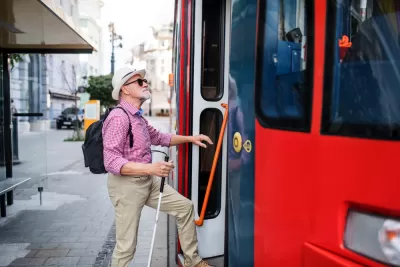
“An app designed to help visually impaired or blind pedestrians use public transit will debut at a Washington subway station on Tuesday,” reports David Shepardson for Reuters. “The app does not use GPS and can operate regardless of cellphone signal strength indoors or outdoors. It loads detailed mapping data onto a smartphone and uses motion sensors on the phone to offer precise directions.”
“Mobility is not a luxury,” said Waymap founder and CEO Tom Pey, who is blind and argues other apps are not precise enough. “It is, in fact, a human right.”
According to the article, “Waymap will be deployed in phases with the goal of deploying the app at up to 30 Metro train stations and nearly 1,000 bus stops by September and across the entire Metro system by early 2023.”
In the future, Pey says people without visual impairments could use the app “to help refine directions and improve the maps” for blind users.
FULL STORY: App to help blind people navigate public transit to debut in Washington

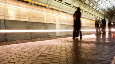
Mobile App Makes DC Transit Easy to Navigate for Visually Impaired Riders
The app gives step-by-step directions and audio and visual cues accessible from anywhere for thousands of bus stops and rail stations.

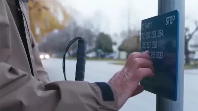
Making Trip Planning Easier for Vision-Impaired Transit Riders
The app provides navigation using audio and haptic cues to improve accessibility for people with low vision.
Braille Signage Now at All Vancouver Bus Stops
The city completed installation of signage for people with visual impairments at over 8,000 bus stops.

Alabama: Trump Terminates Settlements for Black Communities Harmed By Raw Sewage
Trump deemed the landmark civil rights agreement “illegal DEI and environmental justice policy.”

Planetizen Federal Action Tracker
A weekly monitor of how Trump’s orders and actions are impacting planners and planning in America.

The 120 Year Old Tiny Home Villages That Sheltered San Francisco’s Earthquake Refugees
More than a century ago, San Francisco mobilized to house thousands of residents displaced by the 1906 earthquake. Could their strategy offer a model for the present?

BLM To Rescind Public Lands Rule
The change will downgrade conservation, once again putting federal land at risk for mining and other extractive uses.

Indy Neighborhood Group Builds Temporary Multi-Use Path
Community members, aided in part by funding from the city, repurposed a vehicle lane to create a protected bike and pedestrian path for the summer season.

Congestion Pricing Drops Holland Tunnel Delays by 65 Percent
New York City’s contentious tolling program has yielded improved traffic and roughly $100 million in revenue for the MTA.
Urban Design for Planners 1: Software Tools
This six-course series explores essential urban design concepts using open source software and equips planners with the tools they need to participate fully in the urban design process.
Planning for Universal Design
Learn the tools for implementing Universal Design in planning regulations.
Clanton & Associates, Inc.
Jessamine County Fiscal Court
Institute for Housing and Urban Development Studies (IHS)
City of Grandview
Harvard GSD Executive Education
Toledo-Lucas County Plan Commissions
Salt Lake City
NYU Wagner Graduate School of Public Service