


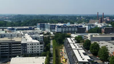
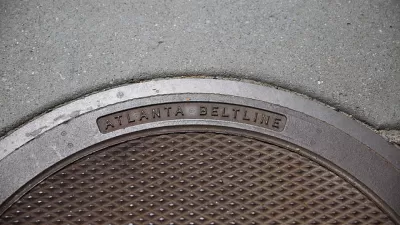
A new way of keeping track of the changes caused by one of the nation's "most ambitious urban redevelopment projects."

Josh Green shares news of an interactive data mapping tool published online by the Atlanta Beltline in partnership with Neighborhood Nexus.
Atlanta BeltLine has published two maps—the Investment Data Explorer and the Demographic Data Explorer. Together, according to Green, the maps are "convenient means of keeping tabs on changes brought, in part, by one of America’s most ambitious urban redevelopment projects."
The Investment Data Explorer, "drills down on funding and progress across BeltLine subareas related to parks, housing, trails, transit and streetscapes, and arts and culture," explains Green. The Demographic Data Explorer "vividly illustrates shifts in population densities, incomes, rent growth, and other metrics since the BeltLine’s conception."
The source article below provides more background and insight into the interactive data tools.
FULL STORY: Atlanta BeltLine launches gentrification-o-meter to track changes

New Study Commissioned for Atlanta BeltLine Transit
The study will assess alignment options for a 13-mile segment of the greenway.

Atlanta Streetcar Expansion Still Moving Forward
MARTA has drastically reduced its plans to construct new rail transit, but one project still has political support from the top at City Hall.
Final Piece of Atlanta BeltLine’s Route Falls Into Place
The choice of a route for the final segment of the Northwest Trail completes the planned route for the entire 22-mile length of the Atlanta BeltLine.

Alabama: Trump Terminates Settlements for Black Communities Harmed By Raw Sewage
Trump deemed the landmark civil rights agreement “illegal DEI and environmental justice policy.”

Planetizen Federal Action Tracker
A weekly monitor of how Trump’s orders and actions are impacting planners and planning in America.

The 120 Year Old Tiny Home Villages That Sheltered San Francisco’s Earthquake Refugees
More than a century ago, San Francisco mobilized to house thousands of residents displaced by the 1906 earthquake. Could their strategy offer a model for the present?

In Both Crashes and Crime, Public Transportation is Far Safer than Driving
Contrary to popular assumptions, public transportation has far lower crash and crime rates than automobile travel. For safer communities, improve and encourage transit travel.

Report: Zoning Reforms Should Complement Nashville’s Ambitious Transit Plan
Without reform, restrictive zoning codes will limit the impact of the city’s planned transit expansion and could exclude some of the residents who depend on transit the most.

Judge Orders Release of Frozen IRA, IIJA Funding
The decision is a victory for environmental groups who charged that freezing funds for critical infrastructure and disaster response programs caused “real and irreparable harm” to communities.
Urban Design for Planners 1: Software Tools
This six-course series explores essential urban design concepts using open source software and equips planners with the tools they need to participate fully in the urban design process.
Planning for Universal Design
Learn the tools for implementing Universal Design in planning regulations.
Clanton & Associates, Inc.
Jessamine County Fiscal Court
Institute for Housing and Urban Development Studies (IHS)
City of Grandview
Harvard GSD Executive Education
Toledo-Lucas County Plan Commissions
Salt Lake City
NYU Wagner Graduate School of Public Service