


Residents have had a chance to oppose the new residential density proposed by the "Charlottesville Plans Together" comprehensive planning process.
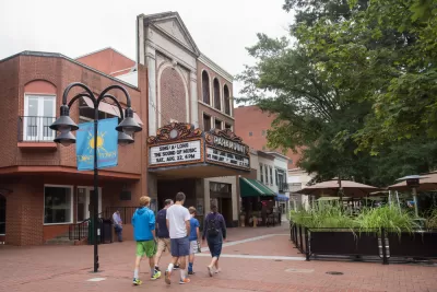
Katherine Knott updates the process of updating the Comprehensive Plan in Charlottesville, Virginia, which recently wrapped up a round of public comment and headed back to the city's Planning Commission for a work session.
Under discussion is an update to the city's future land use map and other chapters of the city's Comprehensive Plan. The entire process has been branded as "Charlottesville Plans Together." Planning consultant Rhodeside and Harwell is working with the city to complete the process.
According to Knott, the recently completed public comment was contentious, with 1,800 comments from the public, most of which focused on the future land use map. The map calls for more residential density and mixed-use developments throughout the city. "Neighborhoods around the University of Virginia and along West Main Street and Fifth Street would see large developments up to five stories, according to the map."
" The increases in density prompted a raft of concerns from community members who were worried about traffic and infrastructure to support the city’s growth, how larger buildings would affect a neighborhood’s character and the overall effect on property values, according to the presentation," reports Knott. Soundbites from either side of the debate are included in the source article.
Whatever version of the future land use map is finally approved, Knott explains that the city will still have to implement the plan with changes made to the city's Zoning Ordinance.
FULL STORY: City Planning Commission reviews future land use map feedback


Charlotte's New, Controversial Comprehensive Plan to End Single-Family Zoning
A tight vote after months of controversy has produced a major zoning reform effort that differs significantly from recent examples on the West Coast and in Minneapolis.
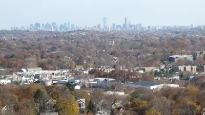
'Housing Choice' Approved in Massachusetts
The Housing Choice initiative, one of the country's most sweeping planning and development reforms to date, was included in a large economic development package approved by the Massachusetts Legislature earlier this week.

How Massachusetts Got its Historic Planning Reform Moment
As reported earlier this month, the Massachusetts Legislature is poised to approve historic statewide land use reforms that would preempt local control of residential development. Here's a detailed account of how the state arrived at this moment.

Alabama: Trump Terminates Settlements for Black Communities Harmed By Raw Sewage
Trump deemed the landmark civil rights agreement “illegal DEI and environmental justice policy.”

Planetizen Federal Action Tracker
A weekly monitor of how Trump’s orders and actions are impacting planners and planning in America.

The 120 Year Old Tiny Home Villages That Sheltered San Francisco’s Earthquake Refugees
More than a century ago, San Francisco mobilized to house thousands of residents displaced by the 1906 earthquake. Could their strategy offer a model for the present?

Ken Jennings Launches Transit Web Series
The Jeopardy champ wants you to ride public transit.

BLM To Rescind Public Lands Rule
The change will downgrade conservation, once again putting federal land at risk for mining and other extractive uses.

Indy Neighborhood Group Builds Temporary Multi-Use Path
Community members, aided in part by funding from the city, repurposed a vehicle lane to create a protected bike and pedestrian path for the summer season.
Urban Design for Planners 1: Software Tools
This six-course series explores essential urban design concepts using open source software and equips planners with the tools they need to participate fully in the urban design process.
Planning for Universal Design
Learn the tools for implementing Universal Design in planning regulations.
Clanton & Associates, Inc.
Jessamine County Fiscal Court
Institute for Housing and Urban Development Studies (IHS)
City of Grandview
Harvard GSD Executive Education
Toledo-Lucas County Plan Commissions
Salt Lake City
NYU Wagner Graduate School of Public Service