


A new methodology can help cities assess the impact of new developments on walkers.
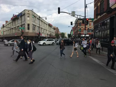
While planners frequently use forecasting models to predict the impact of new developments on traffic, congestion, and road quality, no such model existed for assessing the effects of development on non-drivers. Now, reports Kea Wilson for Streetsblog, "Massachusetts Institute of Technology Researcher Andres Sevstuk has created a sophisticated new methodology for estimating changes in the volume of walkers on city streets at different times throughout the day in response to changes in the built environment, in much the same way that planners estimate how vehicle traffic will change after they break ground on a building or roadway redesign."
Similar traffic impact assessments (TIAs) are frequently used to evaluate the impact of projects. According to researcher Andres Sevstuk, "if the TIA forecast that a project would put more traffic onto city streets than the current road design can tolerate, then the developer typically has to pay to address that — maybe by building extra parking, or paying to widen a road, or paying to adjust traffic signal timing." Sevstuk argues that adding more infrastructure for counting pedestrians could have a "dramatic effect" on our understanding of how land use affects walking in cities.
Sevstuk's model, writes Wilson, "would be re-calibrated by each community using at least some local walking data, but even without those inputs, it can predict pedestrian volumes with roughly 70 to 80 percent accuracy." This information can help cities decide where to build amenities like parks or parking lots and serve as "a critical tool to identify where to prioritize pedestrian improvements that planners haven’t even considered yet." Further, "[o]verlaying projections with actual pedestrian crash data and data on corridors that have been historically disinvested could be even more helpful as leaders work towards ending traffic violence and making cities more equitable."
FULL STORY: New Traffic Model Predicts How New Developments Will Affect Walkers


'The World's Most Beautiful Avenue' Getting A Green Makeover
Paris Mayor Anne Hidalgo approved a new plan to revitalize the Champs Élysées ahead of the 2024 Summer Olympics.
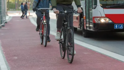
Indy Neighborhood Group Builds Temporary Multi-Use Path
Community members, aided in part by funding from the city, repurposed a vehicle lane to create a protected bike and pedestrian path for the summer season.
Understanding Road Diets
An explainer from Momentum highlights the advantages of reducing vehicle lanes in favor of more bike, transit, and pedestrian infrastructure.

Alabama: Trump Terminates Settlements for Black Communities Harmed By Raw Sewage
Trump deemed the landmark civil rights agreement “illegal DEI and environmental justice policy.”

Planetizen Federal Action Tracker
A weekly monitor of how Trump’s orders and actions are impacting planners and planning in America.

The 120 Year Old Tiny Home Villages That Sheltered San Francisco’s Earthquake Refugees
More than a century ago, San Francisco mobilized to house thousands of residents displaced by the 1906 earthquake. Could their strategy offer a model for the present?

Ken Jennings Launches Transit Web Series
The Jeopardy champ wants you to ride public transit.

BLM To Rescind Public Lands Rule
The change will downgrade conservation, once again putting federal land at risk for mining and other extractive uses.

Indy Neighborhood Group Builds Temporary Multi-Use Path
Community members, aided in part by funding from the city, repurposed a vehicle lane to create a protected bike and pedestrian path for the summer season.
Urban Design for Planners 1: Software Tools
This six-course series explores essential urban design concepts using open source software and equips planners with the tools they need to participate fully in the urban design process.
Planning for Universal Design
Learn the tools for implementing Universal Design in planning regulations.
Clanton & Associates, Inc.
Jessamine County Fiscal Court
Institute for Housing and Urban Development Studies (IHS)
City of Grandview
Harvard GSD Executive Education
Toledo-Lucas County Plan Commissions
Salt Lake City
NYU Wagner Graduate School of Public Service